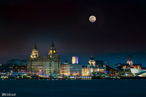
Click on the first image to view all photographs in 'Lightbox' (TM)
For a quick search whilst on this page press Ctrl +F (Windows) or Alt+F (Mac) and enter the street/place you are looking for.
Liverpool 4

 |
| Anfield Kop 1953 |
 |
| Flagpole Corner |
 |
| Anfield rd - 1908 |
 |
| Arkles Lane December 1969 |
 |
| Arkles Lane December 1969 |
 |
| Arnot Street 1960s |
 |
| Arundel st front room on 6.09.57 |
 |
| Barlow Lane and the Leigh Arms 1980 |
 |
| Barlow Lane from Chirkdale st showing the Leigh Arms in 1980 |
 |
| Barlow Lane St Lawrences demolition in 1980 |
 |
| Barlow Square 1959 |
 |
| Barlow Street from No11 on 9.8.65 |
 |
| Barlow Street scotch house rears - 28.9.59 |
 |
| Blessington Road with Sleepers Hill on the left - 13.1.69 |
 |
| Bradewell street on 28.9.59 |
 |
| Brewster street towards the Princess Cinema |
 |
| Brunswick Square off Wewsminster Road8.3.72 |
 |
| Brunswick Square on 8.03.72, this was off Westminster Road. |
 |
| Brunswick Square on 8.3.72 |
 |
| Churney st 3.7.72 |
 |
| Churney street 1972 |
 |
| Churney street showing Sharon Hall on 3.7.72 |
 |
| City Road at Church road west on 22.5.67 |
 |
| Country Road towards Rice Lane at the Breeze Hill junction from St Marys church tower. |
 |
| County rd near Bedford rd on 22.5.67 |
 |
| County Road 8.11.49 |
 |
| County Road at Euston street 22.5.67 |
 |
| County Road at its start showing Nos 1-23 from Carisbrook Road on 5.3.73 |
 |
| County Road at Neston Street 5.3.73 |
 |
| County Road at Nimrod st on 5.3.73 |
 |
| County Road at Oxton st 5.3.73 |
 |
| County road from Eaton st on 5.3.73 |
 |
| County road near Lenthall st showing 218-226 on 16.4.73 |
 |
| Croxton street 18.4.72 |
 |
| Croxton street on 18.4.72 |
 |
| Delamore street at Hale road 1980 |
 |
| Dryburgh street - 6.10.59 |
 |
| Easby road |
 |
| Easby road - 16.6.70 |
 |
| Easby road - 16.6 |
 |
| Everton Valley and Walton road with the Derby pub |
 |
| Everton Valley with Walton Lane fork to the left, Walton Breck rd to the right on 13.1.69 |
 |
| Fountains Road |
 |
| Goodison Park during the World Cup in 1966 |
 |
| Goodison Road - 1970 |
 |
| Kirkdale Homes from Rumney Road. |
 |
| Lake street 1969 |
 |
| Langtry rd 24.2.72 |
 |
| Langtry rd 24.2.72- |
 |
| Lester Gardens in 1958 from near the rear of the Astoria Cinema |
 |
| Lester Gardens in 1958 looking towards the rear of Westminster road baths |
 |
| Melrose Road 24.02.72 |
 |
| Melrose Road - 1960 |
 |
| Oakfield rd from Walton Breck rd in 1969 showing the Methodist church where now stands a petrol station. |
 |
| Priory road between Breck rd and Manningham rd on 06.11.72 |
 |
| Priory Road between Feltwell Road and Clapham road on 1972 |
 |
| Queens Drive 1968 near Walton Lane |
 |
| Rumney Road 18.03.72 |
 |
| Rumney Road 1972 |
 |
| Selwyn street 1980 |
 |
| Sessions Road 18.4.72 |
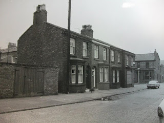 |
| Sessions Road 18.4.72 |
 |
| Sessions road 18.4.72_ |
 |
| Stour st 18.4.72 |
 |
| Stour st 18.4.72__ |
 |
| Stour st corner 18.4.72 |
 |
| Suffield rd 24.2.72 |
 |
| Tetlow street interior 1956 |
 |
| The Astoria, Walton road night view |
 |
| The Astoria, Walton road |
 |
| The Co-op on Walton Road at its junction with Christopher st 1953 |
 |
| The Grapes on the corner of Sellar street and Summer Gardens off Westminster Road with the baths in the background |
 |
| Thomas Frosts, Walton Road 05.02.73 |
 |
| Tintern st 31.3.70 |
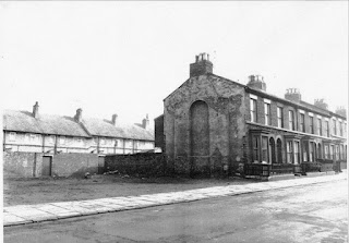 |
| Tintern st 31.3.70_ |
 |
| Walton Breck rd |
 |
| Walton Breck road |
 |
| Walton Lane 1954 |
 |
| Walton Lane 1959. The Police station now stands to the right. |
 |
| Walton Lane at Cherry Lane 22nd May 67 |
 |
| Walton Lane at Priory rd in Sept 1937 |
 |
| Walton Lane Cemetary Gates 1954 |
 |
| Walton Lane towards the valley on 13.1.69 |
 |
| Walton rd 1966 |
 |
| Westminster rd at Tintern st 31.3.70 |
 |
| Westminster road 1980 |
 |
| Westminster road - 31.3.70 |
 |
| Woodhouse street 1969 |
 |
| Ye olde brown cow in 1962 on the corner of Rice Lane with Church Lane. |
 |
| Afghan Street,Everton on 12th January 1968 |
 |
| Albion street 67-69 24.10.66 |
 |
| Albion Street - No65 on 24th Oct 66 |
 |
| Albion Street Nos 67-69 on 24th Oct 66 |
 |
| Alexander pub on Breckfield Road North in 1967 |
 |
| Amos Street 1-25 17.05.65 |
 |
| Amos Street 34-40 17.05.65 |
 |
| Amos Street from No2 on 17th May 1965 |
 |
| Amos Street Nos 22-24 17.05.65 |
 |
| Amos Street, rear of No2 17.05.65 |
 |
| Anderson Street 8-4-59 |
 |
| Anderson Street 23.9.58 |
 |
| Anderson Street no14 showing congestion - 23.9.58 |
 |
| Anderson street No 30-42showing supports |
 |
| Anderson Street Nos 1-17 taken on 6.8.59 |
 |
| Anderson Street on 2-12 23.09.58 |
 |
| Anderson street Rear 23.09.58 |
 |
| Anthony st 21.7.48 |
 |
| Anthony St clearance area 21.07.48 |
 |
| Anthony st from Beatrice street in 1948 |
 |
| Anthony st top end at Netherfiled Road North |
 |
| Arkwright st in 1948 |
 |
| Arkwright st in 1967 from Great Homer st |
 |
| Ashfield Cottage in 1955 |
 |
| Ashfield Cottages 1955 |
 |
| Ashfield Cottages in 1956 |
 |
| Ashfield Cottages scullery and toilet in 1955 |
 |
| Ashfield Cottages |
 |
| Ashfield Street |
 |
| Athol st area 4.11.57 |
 |
| Athol st area 4.11.57_ |
 |
| Athol st area demolition 1982 |
 |
| Athol st area flattened |
 |
| Athol st gasworks in 1963 |
 |
| Athol st gasworks |
 |
| Athol St in 1972 |
 |
| Athol Street on 4th Nov 1957 |
 |
| Athol street |
 |
| Aughton street Nos 1-33 on 23rd Sept 1953 |
 |
| Back Prince Edwin street slum clearance |
 |
| Back Roscommon street 15-45 on 24.8.65 |
 |
| Back Roscommon street entry showing bowing walls between nos 29-31 on 24.08.65 |
 |
| Back Roscommon street showing No.23, taken from the middle bedroom of No24 Sackville street on 24.8.65 |
| Beacon Lane 5.12.67- |
| Beacon Lane 5.12.67 |
| Beacon Lane 13.7.67 |
| Beacon Lane 72-74 on 5.12.67 |
| Beacon Lane 168-170 on 5.12.67 |
| Beacon Lane 180-198 in 1968 |
| Beacon Lane 193-197 5.12.67 |
| Beacon Lane 1967 |
| Beacon Lane - 5.12.67 The Brighton Pub |
| Beacon Lane at Lune st in 1967 |
| Beacon lane former orphanage in 1967 |
| Beacon Lane from Everton Library on 13.7.67 |
| Beacon Lane from Gibb st on 13.1.69 |
| Beacon Lane from Robson st 13.1.69 |
| Beacon Lane from Robson St |
| Beacon Lane in 1968 136-138 |
| Beacon Lane mission in 1967 |
| Beacon Lane orphanage fire late 50s - thanks to K.Rose |
| Beacon Lane orphanage, later Rosenblatts furniture stores. Taken in 1967 |
| Beacon Lane showing the rears of Leadenhall street houses on 13.7.67 |
| Beacon Lane with Ribble st on the right - 13.1.69 |
| Beacon Light pub on Beacon Lane and Wye st. |
| Beacon Street, not to be confused with Beacon Lane. Beacon Lane was in the Great Howard Street area L5, taken here on 9.8.65 |
 |
| Benledi Street 23.1.67 |
 |
| Bentinck Street from Gt Howard st 1968 |
 |
| Add caption |
 |
| Blenheim street 37-53 1971 |
 |
| Blenheim street 116-124 in June 1970 |
 |
| Blenheim Street 126-132 in 1970 |
 |
| Blenheim Street 134-142 1970 |
 |
| Blenheim street 144-152 June 1970 |
 |
| Blenheim street Grapes pub in 1971 |
 |
| Blenheim street. |
 |
| Blundell Grove near Everton Terrace on 20.11.68 |
 |
| Bostock St 29-35 on 7-3-72 |
 |
| Bostock St 33-39 on 7-3-72 |
 |
| Bostock St 55-57 on 7-3-72 |
 |
| Bostock St 63-65on 7-3-72 |
 |
| Bostock St and Kew st rears on 3.10.66 |
 |
| Bostock st from 39a on 7-3-72 |
 |
| Bostock st rears from 69a on 7.3.72 |
 |
| Bostock st rears to 69a - 7.3.72 |
 |
| Boundary st 3.6.58 |
 |
| Boundary st 1972. Crosfields animal feeds. |
 |
| Boundary st East in 1955 towards Gt Homer st |
 |
| Boundary st East in 1955 |
 |
| Boundary st warehouse demolition in 1972 |
 |
| Boundary street 3.6.58 |
 |
| Boundary street 3.6.59 |
 |
| Boundary street - 1972 |
 |
| Boundary street at the canal bridge |
 |
| Boundary street East in 1955 from Gt Homer st |
 |
| Boundary street in 1972 looking towards Vauxhall Road and Crosfields |
 |
| Bramley Moore dock bridge across the dock road. |
 |
| Brandon st 5.12.67 |
 |
| Breckfield Road North 7.1.69 |
 |
| Breckfield Road North 226-228 in 1968 |
 |
| Breckfield Road North 226-228 in 1968 |
 |
| Breckfield Road North at Verona st. |
 |
| Breckfield Road North from No.200 taken in 1967 |
 |
| Breckfield Road North Nos 166-176 taken in 1967 |
 |
| Breckfield Road North rears of Nos 3-15 taken on 18.9.68 |
| Breckfield Road North with Beacon Lane pit on the left. |
 |
| Breckside Ambulance depot |
 |
| Browside 1951. Corpy worker removing the cobbles glaze. |
 |
| Browside Orange Lodge Parade |
 |
| Browside |
 |
| Buckingham street 72-80 05.11.62 |
 |
| Burleigh Road South on 12.12.67 |
 |
| Burleigh Road South towards St Cuthberts at Robson st |
 |
| Candia street Nos 40 to 64 804.59 |
 |
| Carmel st on 12.1.68 |
 |
| Carmel street Nos 3-23 on 12.1.68 |
 |
| Chambers st No28 on 12.12.67 |
 |
| Chambers street 12.12.67 |
 |
| Chambers street nos 1-3 on 12.1.68 |
 |
| Church Place from Heyworth Street on 13.7.67 |
 |
| Church Place No22 on 24.06.68 |
 |
| Cicero Terrace |
 |
| Clarence Grove 05.07.68 |
 |
| Clarence Grove bedroom in 1968 |
 |
| Clifton St off Prince Edwin st, demolished to make way for St Gregorys school. Here we see the rears of Nos 3-17 in 1955 |
 |
| Cochrane st - 17.5.65 |
 |
| Cochrane st from No 39 on 17.5.65 |
 |
| Cochrane st methodist Hill O'Zion church on 17.5.65 |
 |
| Cochrane st - 17.5.65 |
 |
| Commercial Road 17.10.66 |
 |
| Commercial Road 17.10.66_ |
 |
| Commercial road and the B.A.T. 1972 |
 |
| Commercial Road by the Sandhills bridge pub on 17.10.66 |
 |
| Commercial road Evelyn Road 17.10.66 |
 |
| Commercial road in 1951 |
 |
| Commercial Road Lathom pub |
 |
| Commercial Road looking towards Melrose rd in 1951 |
 |
| Commercial road Midland Hotel 17.10.66 |
 |
| Commercial road on 17.10.66 |
 |
| Commercial Road prefabs at the bottom of Gt Mersey street in 1972 |
 |
| Commercial Road Reading pub at the bottom of Swindon st in 1972 |
 |
| Commercial Road Sandhills bridge inn - 17.10.66 |
 |
| Commercial road Sandhills junction |
 |
| Commodore, Stanley Road, Kirkdale |
 |
| Conway street in 1958 |
 |
| Conway street scullery |
 |
| Conway street with the site of the child welfare clinic on 5.11.63 |
 |
| Conway street |
 |
| Conyers st 8.4.59 |
 |
| Conyers st - No 54 8.4.59 |
 |
| Conyers st Rear of 52-54 on 8.4.59 |
 |
| Conyers st No74 8.4.59 |
 |
| Conyers st north side at Kirkdale rd 13.7.67 |
 |
| Conyers st Rear of 52-54 on 8.4.59 |
 |
| Conyers street 4-12 on 15.5.59 |
 |
| Conyers street 38-74 on 8.4.59 |
 |
| Cornwall st from Netherfield Road South ion 13.7.67 |
 |
| Cowl Street 16-20 on 15.7.68 |
 |
| Cowl Street 16-20 on 15.7.68 |
 |
| Cranmer st 23.1.67 |
 |
| Crete st 43-67 8.4.59 |
 |
| Crete st 62-74 8.4.59 |
 |
| Crete st in 1970 |
 |
| Crete st No 55 on 15.4.59 |
 |
| Crete st staircase at No 43 on 15.4.59 |
 |
| Crete street 3-5 15.5.59 |
 |
| Cubbin Street bedroom 1957 |
 |
| Cubbin street scullery 1957 |
 |
| Dalrymple st 3.10.66 |
 |
| Dalrymple st 1965 |
 |
| Dalrymple street 1960 |
 |
| Danby street 14-24 18.9.68 |
 |
| Danby street No37 18.9.68 |
 |
| Danby street No48 - 7.1.69 |
 |
| Daniel street in 1967 |
 |
| Derby cinema at Wilbraham street Scotland Rd |
 |
| Desmond st on 18.9.68 |
 |
| Desmond street 13.7.67 |
 |
| Desmond street 18.9.68 |
 |
| Desmond street No22 |
 |
| Desmond street No22 |
 |
| Desmond street on 7.1.69 showing a damp scullery |
 |
| Desmond street on 18.9.68 |
 |
| Desmond street towards St Benedicts |
 |
| Donaldson street wash-house in 1957 |
 |
| Dorrington street at Portland place. Pic thanks to Sam Perry |
 |
| Downing street 46-42 on 5.7.68 |
 |
| Downing street showing a missing yard wall on 5.7.68 |
 |
| Drayton street on 12.1.68 |
 |
| Dryden street |
 |
| Eastlake St 34-36 on 07.01.69 |
 |
| Eastlake street on 18.9.68 showing the vacant site of Nos 48-50 |
 |
| Eccles st No1 court houses 2-4 rears on 9.4.56 |
 |
| Eccles street No1 Court - houses No2-4 on 9.4.56 |
 |
| Edinburgh Street 3.10.66 |
 |
| Edinburgh street 5.11.63 |
 |
| Edinburgh street with Howe st rears on 3.10.66 |
 |
| Ellison street 1-3 |
 |
| Ellison street at Great Homer st 1307.67 |
 |
| Ellison street stables and yard - 15.7.64 |
 |
| Ellison street_ |
 |
| Ermine st 20-18 on 5.07.68 |
 |
| Ermine street at Mere Lane - 10.3.69 |
 |
| Everton area 1951 |
 |
| Everton area 1951_ |
 |
| Everton area 1959 |
 |
| Everton area - overlooking Netherfield road |
 |
| Everton area on 11.5.48 |
 |
| Everton district in 1949 from the tower of St Georges church aka the iron church |
 |
| Everton Terrace 67-75 in 1956 |
 |
| Everton Terrace garage collapse - complete with Morris Minor on 27.4.56 |
 |
| Everton terrace N0 67 collapse |
 |
| Everton Terrace N067 intrior following collapse |
 |
| Everton Terrace No 67 |
| Everton Terrace on 20.11.63 Beacon Bedding Co |
 |
| Everton Terrace towards Cresswell Mount showing the old police station, itself a former Industrial school. |
 |
| Everton wastelands on 3.2.70 |
 |
| Eyes street - off Breckfield rd North |
 |
| Eyes street No 4 on 5.7.68 |
 |
| Add caption |
 |
| Fairy street looking down towards the Braddocks in 1967 |
 |
| Fitzclarence street on 20.5.66 |
 |
| Flinders street football pitches opposite the BAT in 1973 |
 |
| Friar street at Nun st on 10.3.69 |
 |
| Friar street from Heyworth street on 13.7.67 |
 |
| Friar street in 1968 towards St Georges Heights |
 |
| Gordon street - 16.10.63 |
 |
| Gordon street on 4.11.63 |
 |
| Great Homer st 64-72 on 25.11.54 |
 |
| Great Homer st 140a &b on 7.11.56 |
 |
| Great Homer St at Buckingham street on 16.10.63 |
 |
| Friar street from Heyworth street on 13.7.67_ |
 |
| Great Homer st at Robsart street on 15.4.59 |
 |
| Great Homer st at Virgil Street |
 |
| Great Homer st between Conway st and Robsart street on 7.11.56 |
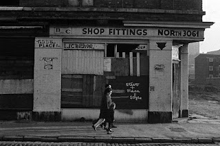 |
| Great Homer st by Bernard Fallon |
 |
| Great Homer St Greaty shopping arcade opens on 14.7.82 |
 |
| Great Homer st towards Netherfield Road |
 |
| Great Homer street 112a-114at Rose Vale in 1955 |
 |
| Great Homer street 140a-b on 15.4.59 |
 |
| Great Homer street 220-224 |
 |
| Great Homer street 226-228 into 2-4 Seacombe st |
 |
| Great Homer street 244-246 on 27.8.59 |
 |
| Great Homer street 254-258 on 27.8.59 |
 |
| Great Homer Street at Arkwright Street on 29.3.55 |
 |
| Great Homer street at Beatrice street on 7.11.56 |
 |
| Great Homer street at Dryden st in 1958 |
 |
| Great Homer street at Elias street on 16.10.63 |
 |
| Great Homer street at Elias Street showing the Foresters Arms on 16.10.63 |
 |
| Great Homer street at Luther Street on 13.7.67 |
 |
| Great Homer street at No14 Court - Mona Terrace on 7.11.56 |
 |
| Great Homer street at Robsart street on 15.4.59 |
 |
| Great Homer street at Roscommon street |
 |
| Great Homer Street at Sheridan Street on 28.2.58 |
 |
| Great Homer street from Back Roscommon Street on 25.11.54 |
 |
| Great Homer Street in 1966 |
 |
| Great Homer street in 1967 |
 |
| Great Homer street rear of 218 |
 |
| Great Homer street Twist's Fishmongers |
 |
| Great Homer street. 248-250 The church above was accessed around the corner at No1 Potter street. 27.8.59 |
 |
| Great Homer Street_ |
 |
| Great Mersey street towards St Alphonsus on 8.5.72 |
 |
| Grecian Terrace - 13.7.67 |
 |
| Harrogate st - Pic by Paul Oulton |
 |
| Havelock st 1960 |
 |
| Havelock st |
 |
| Havelock Street |
 |
| Heriot street in 1972. The Alexandra pub and St Catherines school. |
 |
| Heyworth st 12-18 at Desmond st on 18.9.68 |
 |
| Heyworth st 28-20 on 18.9.68 |
 |
| Heyworth st 30-36 on 18.9.68 |
 |
| Heyworth st 38-48 at Eastlake st - 18.9.68 |
 |
| Heyworth st 48-40 at Eastlake st - 18.9.68 |
 |
| Heyworth st 50-64 on 18.9.68 |
 |
| Heyworth st 66-72 on 18.9.68 |
 |
| Heyworth st 72-70 on 18.9.68 |
 |
| Heyworth st 74-80 on 18.9.68 |
 |
| Heyworth st 82-96 between Hamilton rd and Danby st on 18.9.68 |
 |
| Heyworth st 93 The Raven on 18.9.68 |
 |
| Heyworth st 96-90 at Hamilton rd 18.9.68 |
 |
| Heyworth st 97 on 3.6.65 |
 |
| Heyworth st 101-105 on 3.6.65 |
 |
| Heyworth st 105-111 at Minera st on 3.6.65 |
 |
| Heyworth st 113-119on 3.6.65 |
 |
| Heyworth st 116-112 at Friar st on 3.6.65 |
 |
| Heyworth st 153 on 17.5.65 |
 |
| Heyworth st 157 on 17.5.65 |
 |
| Heyworth st 165 on 17.5.65 |
 |
| Heyworth st 171 on 3.6.65 |
 |
| Heyworth st 183-185 on 3.6.65 |
 |
| Heyworth st - 159-161 The Priory pub on 3.6.65 |
 |
| Heyworth st -N064 rear 18.9.68 |
 |
| Heyworth st at Cochrane st.The Raven |
 |
| Heyworth st at Minerva street and the arl rag n' bone man |
 |
| Heyworth st in 1951 |
 |
| Heyworth st No80 at Danby st on 18.9.68 |
 |
| Heyworth st No 64 at Lance - The Garrick pub on 18.9.68 |
 |
| Heyworth St No 129 3.6.65 |
 |
| Heyworth st Priory Pub |
 |
| Heyworth st, the London Stores pub on 18.9.68 |
 |
| Heyworth street 10-6 on 18.9.68 |
 |
| Heyworth street 13.7.67 |
 |
| Heyworth street 36-30 at Eastlake street - 18.9.68 |
 |
| Heyworth street area demolition |
 |
| Heyworth street CPO area 10.04.70 |
 |
| Heyworth street in the mid 60s |
 |
| Heyworth street No90 on 18.9.68 |
 |
| Heyworth street on 20.11.63 |
 |
| Heyworth street. St. Benedicts and the Thistle pub, now May Duncans |
 |
| Heyworth Street |
 |
| Hodder street 6-24 8.1.68 |
 |
| Hodder street entry - Carmel street were the even numbers on the other side 8.1.68 |
 |
| Howe st 40-50 Scotch houses - 5.11.63 |
 |
| Howe st 71-77 rears on 5.11.63 |
 |
| Howe st 79-85 on 4.11.63 |
 |
| Howe street 3-21 Scotch houses - 5.11.63 |
 |
| Howe street furniture factory - 4.11.63 |
 |
| Howe street No70 on 4.11.63 |
 |
| Joshua street 1967 |
 |
| Kepler st 20.11.63 |
 |
| Kerferd st 13.7.67 |
 |
| Kerferd st No7 off Village st on 7.7.66 |
 |
| Kerferd st Welsh baptist chapel - 20.5.66 |
 |
| Kerford st - 20.5.66 |
 |
| Kew street rooftops towards Greaty in 1969 |
 |
| Kew street tenements in 1969 |
 |
| Kew Street |
 |
| Kirkdale goods warehouses (1880-1968) |
 |
| Kirkdale rd 13.7.67 |
 |
| Kirkdale rd 1964 |
 |
| Kirkdale rd at the Goats Head pub 13.7.67 |
 |
| Kirkdale Road 13.7.67 |
 |
| Kirkdale road 143-145 on 13.7.67 |
 |
| Kirkdale Road from the Goats Head |
 |
| Kirkdale sidings showing the BAT (British American Tobacco) factory. |
 |
| Lambeth rd 99-83 in 1970 |
 |
| Lambeth rd 145-135 |
 |
| Lambeth rd from Stanley rd towards Commercial rd |
 |
| Lambeth rd showing the vacant site of 77-81 near Harcourt st on 16.6.70 |
 |
| Latham street at Stanley rd |
 |
| Latimer street |
 |
| Leadenhall st 60-64 towards Wye st on 22.1.68 |
 |
| Leadenhall street 6-20 on 12.1.68 |
 |
| Leadenhall street 102-106 on 12.12.67 |
 |
| Leadenhall street 116 on 12.12.67 |
 |
| Lightbody street in 1968 |
 |
| Lightbody street in 1982 |
 |
| Limekiln Lane 148-146 at Wright st in October 1971 |
 |
| Limekiln Lane at Hornby street towards Scotland Road in 1964 |
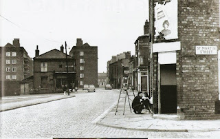 |
| Limekiln Lane at St. Martin street |
 |
| Limekiln Lane prefabs in 1970 |
 |
| Logan Towers 1972 |
 |
| Logan Towers 1972 |
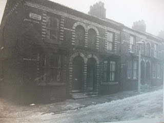 |
| Logan Towers 1972 |
 |
| Louisa Street near Mere Lane 10.3.69 |
 |
| Lune street 9-27 on 08.01.68 |
 |
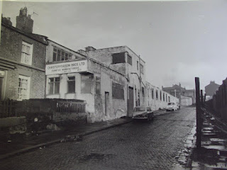
| Mark st 47-49 and 149-151 St Domingo Rd |
 |
| Mark street 27-31 was a furniture factory, taken on 2.02.68 |
 |
| Mark street and Rock View heights on 02.02.68 |
 |
| Mark street former Mitchell Bros site on 02-02-68 |
 |
| Mark street which was Mitcell Bros 02.02.68 |
 |
| Mark street |
 |
| Mark street_ |
 |
| Mere Lane 7-17 rears on 12-01-68 |
 |
| Mere Lane 33-37 12-12-67 |
 |
| Mere Lane 37-43 12-12-67 |
 |
| Mere Lane 39-45 12-12-67 |
 |
| Mere Lane 49-55 12-12-67 |
 |
| Mere Lane. Rear of 35-55 on 12-12-67 |
 |
| Mile End - 1969 |
 |
| Milford st at Gt Howard street 9.8.65 |
 |
| Milford st-Newport Street demolition in 1957 |
 |
| Millard st 1965 |
 |
| Mitford street - 1949 |
 |
| Mould Street showing the rears of Skirving Street in 1955 |
 |
| Mould Street with Schofields Tower in the background |
 |
| Nesfield st 21-08-79 |
 |
| Netherfiel rd South showing the Crescent Vaults and the Italian reformist heights. |
 |
| Netherfield rd 183 North at Ellison street |
 |
| Netherfield rd 303-307 on 30.12.68 |
 |
| Netherfield rd at Edinburgh street in 1964 The Albion |
 |
| Netherfield rd North 53 55 at Rose Vale in 1953 |
 |
| Netherfield rd North 133-135 at Gordon st on 04-11-63 |
 |
| Netherfield rd North 153-157 at Buckingham street on 4.11.63 |
 |
| Netherfield rd North 161-163 at Howe street on 4.11.63 |
 |
| Netherfield rd North 165 at Howe st on 4.11.63 |
 |
| Netherfield rd North 313-321 on 30.12.68 |
 |
| Netherfield rd North 340 on 27.10.54 |
 |
| Netherfield rd North - 1967 |
 |
| Netherfield rd North at the John Bagot Hospita |
 |
| Netherfield rd North at Zante Street in 1949 |
 |
| Netherfield rd North in 1967 |
 |
| Netherfield rd on 297-299 30.12.68 |
 |
| Netherfield rd South meets Netherfield rd North at St Georges Hill. |
 |
| Netherfield rd South Orange Lodge parade in the 50s showing the Everton viewing platform. |
 |
| Netherfield rd South Orange Lodge parade in the 50s showing the Everton viewing platform. |
 |
| Netherfield rd south towards the heights at the top of Roscommon street. |
 |
| Netherfield rd south |
 |
 |
| Netherfield road North |
 |
| Netherfield road south. |
 |
| Netherfield road__ |
 |
| No2 Rockingham street was the Sandhills Hotel - 17.10.66 |
 |
| Northumberland Terrace 126-128 on 24.10.66 |
 |
| Northumberland Terrace at Bethesda Street on 24-10-66 |
 |
| Nursery street - 1966 |
 |
| Pagewood street No8 08-01-68 |
 |
| Penrose Street in 1967 |
 |
| Penrose street showing damp in No29 in January 1968 |
 |
| Petton street 1956 |
 |
| Petton Street in 1930 |
 |
| Portland Place.No1 Court Pic thanks to Sam Perry |
 |
| Potter Street 3-19 on 06-08-59 |
 |
| Potter street 4-18 on 6.8.59 |
 |
| Potter street 18-42 06-08-59 |
 |
| Potter street and the entrance to the Evangelist church - 27.8.59 |
 |
| Potter street on 6.8.59 23-41 |
 |
| Premier Street No 19-29 on 5-07-58 |
 |
| Prince Edwin lane refuse collection |
 |
| Prince Edwin Lane |
 |
| Prince Edwin st 1955 |
 |
| Prince Edwin street court |
 |
| Prince Edwin street showing the prefabs in front of the old blocks. Photo by UJO NRY. |
 |
| Prince Edwin street_ |
 |
| Prince Rupert Street 20.5.66 |
 |
| Priory Grove 5-7 on 24.6.68 |
 |
| Priory Grove 118-132 on 5.7.68 |
 |
| Priory Grove from Friar Street 10.3.69 |
 |
| Priory Grove No67 on 5.7.68 |
 |
| Priory Grove No67 on 24.6.68 |
 |
| Priory Grove No 4 on 24.6.68 |
 |
| Priory Grove No 112 in June 1968 |
 |
| Priory Mount 3.6.65 |
 |
| Reading Street - 1956 |
 |
| Robsart street No 9 Court on 21.4.59 |
 |
| Robson st at Drayton st 1967 |
 |
| Robson street in the mid 60s |
 |
| Robson street recreation ground on the site of the pit near the Grizedale estate in 1977. Photo by Keith Rose. |
 |
| Roscommon st CPO area just prior to demolition. |
 |
| Roscommon st looking East from Greaty in 1967 |
 |
| Roscommon street area |
 |
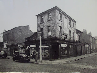
| Roscommon street at Higham st 1961 |
 |
| Roscommon street Gt Homer street junction on 25-11-54 |
 |
| Rose Vale 5-13 from Portland Street on 17-03-55 |
 |
| Rose Vale from Portland Street on 17.03.55 |
 |
| Rose Vale in 1955 |
 |
| Rupert Grove No13 on 07.07.66 |
 |
| Rupert Grove No18 on 07.07.66 |
 |
| Rupert Hill22.05.67 |
 |
| Rupert Hill22.05.67 |
 |
| Ruperts Place |
 |
| Rutland st 30-52 on 26.6.68 |
 |
| Rutland Street 21-33 on 5-7-68 |
 |
| Sackville street 14-40 on 24.08.65 |
 |
| Sackville st No5 on 24.8.65 |
 |
| Sackville st No9 24.8.1965 |
 |
| Sackville st No15- 24.8.65 |
 |
| Sackville st No26- 24.8.65 |
 |
| Sackville st No39- 24.8.65 |
 |
| Sackville st on 24.8.65 showing dilapidation |
 |
| Sackville stree 14-40 on 24.08.65t |
 |
| Sackville street 71-41 24.8.65 |
 |
| Sackville street back bedroom on 24.8.65 |
 |
| sackville street chimney of No9 taken from No11 on 24.8.65 |
 |
| Sackville street demolished |
 |
| Sackville street demolition |
 |
| Sackville street from Mazzini Heights. Thanks to Sam Perry |
 |
| Sackville street No7 on 24.8.65 |
 |
| Sackville Street No22- 24.8.65 |
 |
| Sackville street with Mazzini Heights newly created at the top of the street. Photo with thanks to Sam Perry. |
 |
| Sandhills Bee Mills |
 |
| Sandhills Lane |
 |
| Scotland road 14.10.56 |
 |
| Scotland Road 271-277 rears in 1971 |
 |
| Scotland Road 1949 |
 |
| Scotland Road 1958 from Addison street looking north. |
 |
| Scotland Road 1958 |
 |
| Scotland Road 1960 |
 |
| Scotland Road 1962 |
 |
| Scotland road and the remnants of its mill in 1947 |
 |
| Scotland Road area mobile |
 |
| Scotland Road at Hornby st and Tenterton st. |
 |
| Scotland road at Taylor street in 1970 |
 |
| Scotland Road in 1958 |
 |
| Scotland road in 1967 |
 |
| Scotland Road in 1967_ |
 |
| Scotland Road in 1978 towards Limekiln Lane. |
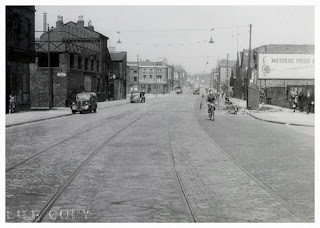 |
| Scotland Road meets Stanley Road - 1951 |
 |
| Scotland Road near the Parrot pub. |
 |
| Scotland Road showing the Roundcounter cafe with its one time distinctive landmark tower. This is at Bevington Hill. |
 |
| Scotland Road towards the Roundcounter cafe in 1966 |
 |
| Add captScotland Road tramion |
 |
| Scotland Road_ |
 |
| Scottie Road traffic - minus road markings. |
 |
| Seacombe st - 1965 |
 |
| Shrewsbury House youth club entrance on Portland Street. |
 |
| Shrewsbury House youth club. Photo thanks to Sam Perry. |
 |
| Silvester street 1967 |
 |
| Silvester street |
 |
| St Domingo Grove 1966 |
 |
| St Domingo Road 67-69 on 24.10.66 |
 |
| St Domingo road 1967 |
 |
| St Domingo Road from Mark st on 2.2.68 |
 |
| St Domingo Road No49 on 24.10.66 |
 |
| St Georges church tower view in 1949 |
 |
| Add caption |
 |
| St Martin street 13-17 towards Scotland Rd 1970 |
 |
| St Martin street 27-35 in 1970 towards Scottie |
 |
| St Martin street 30-36 1970 |
 |
| St Martin street 38-42 1970 |
 |
| St Martin street from Limekiln Lane - June 1970 |
 |
| St Martin street 6-10 in 1970 |
 |
| St Martins cottages 1954 |
 |
| St Martins cottages 1977 |
 |
| St Martins cottages - 1967 |
 |
| St Martins cottages and the Simmy playground |
 |
| St Martins cottages rears |
 |
| St Martins cottages_ |
 |
| Stanley road at Fountains road |
 |
| Stanley road at Lambeth road |
 |
| Stanley road at Lambeth road_ |
 |
| Stanley Road at Latham street |
 |
| Stanley road bridge completion 31-12-46 |
 |
| Stanley road East side looking South towards the city |
 |
| Stanley Road looking North near Latham street. Thanks to Johnny Blue |
 |
| Stanley Road looking South past Harebell street |
 |
| Steel Street on 10th April 72. Athol st gasworks and Logan Towers are in view |
 |
| Taliesin street 2-80on 17.8.65 |
 |
| Taliesin street delapidated kitchen on 17.8.65 |
 |
| Taliesin street entry covering house numbers 32-2 taken on 17.08.65 |
 |
| Taliesin street No32 exterior on 17.8.65 |
 |
| Taliesin street No40 on 17.8.65 showing instabiliity |
 |
| Taliesin street No42 on 14.9.65 |
 |
| Taliesin street No81 showing a metal flying shore to the gable wall on 17.8.65 |
 |
| Taliesin Street No 32 showing damp on 14.9.65 |
 |
| Tariff st from Vauxhall Road on 23.1.67 |
 |
| Tate & Lyle silo conveyor at Huskisson dock - 1957 |
 |
| Tate and Lyle at Chisenhale st and Pall Mall |
 |
| Tate and Lyle demolition 1983 |
 |
| Taylor st 14.9.65 Henry Moore |
 |
| Taylor st 14.9.65-- |
 |
| Taylor st 14.9.65- |
 |
| Taylor st 14.9.65 |
 |
| Taylor st 14.9.65_ |
 |
| Taylor st 14.9.65__ |
 |
| These arches spanned Vauxy from two parts of the Tates site, the one on the right being just past the Green Man pub. |
 |
| Thirlmere Road 10.3.69 |
 |
| Thomaston street. The shop is No.4, the waste ground was No.2. Taken on 27th Aug 59 |
 |
| Tillotsons cardboard box manufacturers. This is the side entrance on Sandhills Lane as seen on 08.05.72 |
 |
| Townson street 1969. Anfield, home of LFC is pictured across the main road at the bottom. |
 |
| Vauxhall Road 30.10.51 at Tatlock Street |
 |
| Vauxhall Road and Tates 1982. Another photo of Vauxy on here shows the arch spannnig Vauxy near the Green Man pub. On this photo you can see where the walkway has been bricked up. |
 |
| Vauxhall Road and Tates, 1982 |
 |
| Vauxhall Road at Tatlock street 30.10.51 |
 |
| Vescock street on 23.01.67 |
 |
| Village street town plan appeals office in 1961 |
 |
| William Moult st 3.10.66 towards Great Homer street |
 |
| William Moult st 3.10.66 |
 |
| William Moult st 14.9.65 |
 |
| William Moult street 3.10.66 showing the rears of Bostock st |
 |
| William Moult street 14.9.65-- |
 |
| William Moult street 14.9.65- |
 |
| William Moult street 14.9.65 |
 |
| William Moult street 14.9.65_ |
 |
| Wright st 2-22 1971 |
 |
| Wright st 18-20 in 1971 |
 |
| Wright st 21.1.67 |
 |
| Wright st - 1983 |
 |
| Wye st 1967 |
 |
| York Place showing the side view of 62 Albion st on 24.10.66 |
 |
| York Place side view of 62 Albion st on 24-10-66 |
 |
| Zante Street at Kirkdale road on 15th April 1959 |
 |
| The Liver Hotel, Robson street in 1967 |
 |
| The meter at 307 Netherfield rd North on 30.12.68 |
