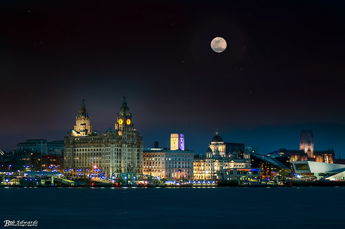
Click on any image to view them all in 'Lightbox' (TM)
For a quick search whilst on this page press Ctrl +F (Windows) or Alt+F (Mac) and enter the street/place you are looking for.
Many of these 1980s pictures were taken by Joe Devine. An ex
neighbour of mine who must've had good shoe leather and knees, judging by the
places he traipsed around.. Other contributions include my own and persons who
have kindly granted their permission and have been given the appropriate
credit. Also there are three photographs at the top of the page, courtesy of Glynne Gianelli, the nephew of John Frank and Maria Gianelli.
An index to which photographs are on this page is at the
bottom of this page.


 |
| Islington Place towards Gerard Gardens |
 |
| Gianellis Chippy, the best Chips 'n' Fish in the city ! |
 |
| Gianelli's at number 2 Islington Place showing the Wellington Monument St Georges Hall and St John Beacon, these photographs are all c.1977 when demolition work had begun in the area. © Glynne Gianelli |


The area of Clayton Square, Cases Street, Parker Street and
Elliot Street was much changed for the building of the Clayton Square Shopping
Centre. Many people can't believe that the road sloped so much that we have the
steps that now exist leading up to Gt Charlotte Street. The Jacey Cinema which
became the Blessed Sacrament Holy Shrine was lost as well as pubs such as
Egerton's, Casey's Bar and The Villiers.


Church Street, pre-pedestrianisation (thanks to Rob) then a
Green Goddess army fire engine with its civil counterpart on the same street
some years later. A horsedrawn Higsons dray cart advertisement heads up Richmond
Street towards Williamson Square which
is shown in the next photo as it was before the water feature. Hood Street at
the bottom of Roe Street with its walkway bridge and to finish off, a fantastic
night view of St. George's Place in the 1961 by Brian Saville. A much preferred
scene than is currently on show.


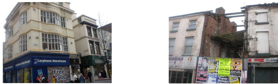
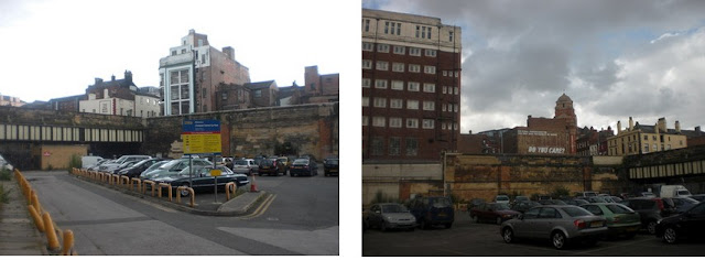
Three views of the Whitechapel Post office which seems to
have come and gone in a very short space of time. The Met Quarter building, a
continuation of the Victoria Street G.P.O. now stands here. The last pic is
courtesy of NancyO.


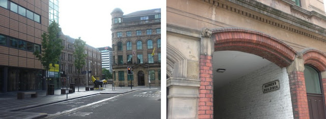
Entering Dale St from the Churchill Way flyover (westbound) as viewed from the roof of Blackburn Assurance Building.
A view up Moorfields, past the Wizard's Den towards Exchange Station. This Street is now much changed
Commutation Row, built at the time of the tax of the same name once contained 12 properties, 4 of them being pubs. This now contains a single block of apartments.
A view up Moorfields, past the Wizard's Den towards Exchange Station. This Street is now much changed
Commutation Row, built at the time of the tax of the same name once contained 12 properties, 4 of them being pubs. This now contains a single block of apartments.

Castle Street in the 1980s taken by Ken (Springy) Notice the
old Police Jeep which offered rides for free.
The Games shop was a
favourite with many a child who pined for 'Hobbies'.
Victoria Street which contained underground toilets which
split the traffic as it entered from the West.


A demo makes it way down James Street which then had the
bridge across to Wilberforce House.
Mann Island and the Voss Motors building which has just been
demolished (July 07) for new apartments.
A scene which has hardly changed, looking down Water st.


Peek-a-boo. The Tower as seen from Pall Mall. The
Metropolitan Cathedral of Christ the King to give it its full name is viewed
here in a mixture of architecture from four different decades. A nice red
Vauxhall Viva and front gate post on Hope St is the foreground in the next
picture with thanks to Martin S.


Islington. Transport House boxing club, Barney's sweet shop and Peppers Public House can be seen here but have now all bitten the dust.

Manchester st. Another dozen properties including the Games shop, the Batch hatch, Shank's (ex The Tiger) Gilroy & County, Ace Security Services, An amusement arcade, Callan Military, Yates and the old furniture shop.

The Byrom Street road improvement scheme saw the demolition
of tenement blocks such as Gerard and Fontenoy Gardens. Here in the background
is Blackburn Chambers.

The Leeds Street area as seen from Scotland Road at its South end. A crane demolishes the last warehouse on Addison Street as road widening and a new housing estate is to soon get underway.

St. John's house stands alone in 1987. The car park on the former Queen's Square now contains the Marriot Hotel, bars and restaurants.

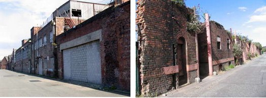
Moss St. A row of delpidated properties including Aspinall's floor coverings and Hartleys auction rooms. A real grot spot that could do with more than a make over. This shot is from 1990.

Merseyside Collectors Centre as remembered in Temple Court.
The building once housed Livingstones, a night club of the late 70s.

Lord Nelson St. looking towards Lime St. This terrace has since undergone a bit of much needed tlc.

Bombdies galore! Islington, The block from Camden St to Fraser St as it was in 1990. During the 1970s, these were to serve the local kids well during the build up to bonfire night.
The block bounded by Norton St, Islington and Fraser St.
Here now stands the coach station.


Shaw Street. The first two pics are the West side. Firstly
from the top of William Henry St and then nearer the Islington end. The 3rd pic
is the East side just past the Collegiate and where Staples office equipment
now stands.


More bombdies on the fringe of the city centre. The doss
house on the corner of Springfield in the first two pics has now been cleared
for the new city fire station. The 3rd pic shows a curved terrace on Fox st
which stood next to St. Mary of the Angels church (the Friary) and is now
wasteland.


Follow the last pic around into Everton Brow and this is
what you'd find. Within these shacks, businesses operated such as Railton's
sweet shop, Kit's Chippy and Joe Mitchell's workshop. The next two pics are of
Soho Street, firstly looking towards Everton Brow and then face on with the
Piggeries and John F. Kennedy heights in view. Properties here consisted of
John Evans Engineering, the Ah Thi Laundry and Cotters barbers.


A close up of the last two premises on the last pic. The Ah Thi Laundry and Cotters barbers shop.
Max's barbers, Audley St. (nicknamed the mad russian) by kids unfortunate enough to have to suffer the 'basin head' haircut at the hands of his competitor, Mr. L. Cotter. (as seen previously)
Max's barbers, Audley St. (nicknamed the mad russian) by kids unfortunate enough to have to suffer the 'basin head' haircut at the hands of his competitor, Mr. L. Cotter. (as seen previously)
Arden House salvation Army hostel on Bevington Bush which
started life as an hotel. Seen here from Chaucer St.

Tenement backdrops feature in this section. John Gianelli's
chip shop on Christian st served meals to the rich and famous appearing on the
nearby Empire Theatre. John, his brother Frank and sister Maria were well known
local figures in this area which was known as Little Italy in the early 1900s.
Gerard Gardens can be seen behind. The next shot, overlooking the Vauxhall
Road/Tithebarn st junction shows the curved Prouts Garage which you could drive
in one side and out of the other. Here, it has been taken over by Heather's
coach tours. The wasteland facing has been used by the JMU, Vauxhall Gardens is
in the background. The last pic is looking eastwards up Burlington st towards
the Black Dog pub on the right (now a bookies) and Portland Gardens on the
left.


J.P. O'Briens, Pall Mall who have supplied many a barrel and
party 7 to local partys. A snowy scene across Bevington Bush and down Blackstock St showing the former St. Bridgets school which became a BCG and nit nurse clinic.Looking towards the Pier Head along Wapping from Blundell St. The warehouses on the left are now prestige apartments.

Pilgrim St on the fringe of the city centre. Old properties
are still in use and each picture is the continuation of the last. A fine part
of town.


Rice st facing Ye Cracke pub. New housing built to
compliment the old in this area.
An interesting first floor extension to the rear of property
on Mount Pleasant.
Jamaica House on Upper Parliament street looks like it's
lost this argument with a digger.


There is lots of industry within a stones throw of the city
centre though these pictures show what once was rather than what still is.
Looking towards Old Hall st and St. Paul's eye hospital in the middle distance,
we have Bibby's corn mill on the right. Costco and Toys R Us now stands here on
what was Formby street. If you turned your back and looked in the opposite
direction along Gt Howard street past the Victoria pub you would see the Graham
Gratrix sign which was a landmark in the area for many years. Looking through
one of the Exchange station line bridges at Whitley st from Love Lane and you
can see the Goat public house.


Looking up Porter st from the dock road and across Gt.
Howard street and up Sprainger st. Dods Vaults stood on the corner opposite
Graham Gratrix bathrooms supplies. Tate and Lyle sugar refiners can be seen
behind. Lascar House can be seen here on Waterloo Road, again, Tate's forms the
backdrop. The last pic is looking South along the dock road with the Tobacco
warehouse on the left and Clarence dock power station with its 3 ugly sisters
chimneys on the right.


Fairries on Vauxhall Road was also part of Tate & Lyle.
Here it can be seen whilst looking North beyond Burlington st. Eldon st
tenements are visible on the right which stood behind the Glass House pub. The
warehouse attached to Fairries can be seen next. The newer brick at first to
third floor level in the bricked up archway once housed a bridge which spanned
Vauxhall Road to its offices on the East side. The last pic shows the circular
turret like structure, it's 1847 date and grade II listing didn't save this
building. George Lyons & sons Ltd scrap yard was next door, the bus is the
21E heading for Walton.

The Swing bridge in operation facing United Molasses.
Heading out of town northwards and this delapidated row of houses are on Fountains Road, Kirkdale.
Sign city. The corner of Bankhall St and Stanley Rd.

Portland Place behind Gt Homer st. A hidden little terrace.
Roscommon st and the demolition of property facing the
School and the Cotton Picker pub.
Shaw st, looking towards the heights on Netherfield Rd.


Maybe it's Sunday but this is a quiet scene on Nethy. Ann
Fowlers women's hostel is boarded up, Mazzini, Garibaldi and Cavour House are
in the distance.
A disused chapel on Hampton st. This is not a route for
cyclists with dodgy brakes. This was demolished in Jan 09.
A Learner bus driver
passes along St Oswald's Street, Old Swan past the tenement gardens and towards
Edge Lane. Picture with thanks to Rob.

The Walton bound 85 passes the maisonettes in Mill st.
Picture courtesy of Rob.
109-115 Park Road, still standing and hopefully will remain
so after a revamp. ***SEE LATER ON PAGE***
Yates St, which like neighbouring Corn St is elevated and
thankfully is in good condition.


Summer 1981 and the aftermath of the Toxteth riots. First we
see two burnt out cars on the junction of Park Way and property which fell down
during its blaze behind Princes Road.


A crash scene on Queens Drive.
A motorbike & sidecar in Clubmoor.
A mobile shop on Grosvenor St. Closed for business.


Woolton Village and surrounding roads, July 07.

Eldon Grove in 1990 and currently undergoing renovation.
Opened in 1914, other pre WWI workmens dwellings like this existed largely in
the Bevington street area as well as the south end but these are the only
remaining specimens.
Western Avenue, Speke. 1930s tenement style buildings like this still exist overhead shops on both sides of the avenue at its west end.
Western Avenue, Speke. 1930s tenement style buildings like this still exist overhead shops on both sides of the avenue at its west end.
(Right) The cellar of 94 Seel street was where my parents were
living when they had my older bro Joe in 1951.


Picton Clock Wavertree and the old Abbey Cinema which is now
a Somerfield.
Hale Road, Speke.
Hale Road, Speke.
Southern Road, Speke.

A 1930s block of tenement flats above shops off Church Road,
Litherland, also showing the rear balconies.
Ford St and Paul St off Vauxhall Road. Once a hive of industry, as captured by Ron Formby of the Scottie Press.

A disused Melly Fountain on the Princes Dock estate behind
the Malmaison hotel.

(Left) Looking down Moorfields on a glorious August morning. The new art installation in Cross Keys House can be seen literally in full swing on the right.
(Right) Tempest Hey seen here from Tithebarn Street. These old
warehouses, still to be cleared can tell a story or two of the city's
industrial past.


Walls of distinction. The first one off Wavertree Road
commemorates Stevenson's Rocket. Edge Hill Station is not far from this spot.
The side wall of what was Ma Daley's pet shop in Tithebarn
Street can be seen in it's original state on the right, and tarted up with a
Birkenhead dockside scene more recently.


A war reminder in the shadows of the Citadel (Derby House)
Vauxhall Road and the Marybone student accommodation as captured by Ron Formby.


Vauxhall Road and the Marybone student accommodation as captured by Ron Formby.


Art Deco 1930s Liverpool. Dovecot Place houses a row of
shops with flats above, built in a crescent off East Prescot Road. The 3rd pic
shows another row on Kingsway in Huyton, a feature of the Huyton and Dovecot
area as there are others on the likes of Hillside Road and Greystone Road. Pic
4 is of Adshead Road off Muirhead Avenue. Another area built in the 1930s under
the direction of city architect, Lancelot Keay, the art deco influence
noticable throughout. The next pic shows one of three seperate similar blocks
which line the North side of Walton Hall Avenue and The East Lancs Road. Flats
at the top end of Western Avenue, Speke can be seen next, following by 1930s
houses facing the English Rose pub on Mackets Lane, Woolton. The bottom row
features a little tenement block on Blackhorse Lane, Old Swan, part of St.
Andrews Gardens which is known as the Bullring and finally The New Dock pub,
Tyrer st, Birkenhead
Quaint and old Liverpool

Barlow Lane which leads up to Spellow Lane. Chatham Street
complete with a Victorian post box. Everton Road contains a row which once
housed the Liverpool Red Triangle karate club.


A surviving Georgian Terrace on Great Mersey Street,
Kirkdale, half of which has been renovated from a priests house (St. Alphonsus)
into the Rotunda College, which is actually 3 houses knocked into one and are
joined at different levels inside. The city's 2nd Jamaica House on the corner
of Dale st and Vernon st (the other one seen earlier on Upper Parliament st).
This one has just been declared structurally unsafe and demolished within a
month (Dec 07). Further East along Dale Street on the corner of Cheapside is a
delapidated row which looks even more structurally unsafe.


One of a number of the quiant parts of old Liverpool. This
little house on East Prescot Road now houses a party shop. Nearby in this
Knotty Ash district is Little Bongs, the entrance of which is shown on pic 2.
The next pic shows the continuation of the road.


These could be off an olde English village jigsaw box lid.
Off Thingwall Road is Wavertree Nook Road and Wavertree Garden suburb institute
followed by the village green.


Lord Nelson Street, happily renovated during the 1990s to
its former glory as was nearby Seymour Street. Oriel House on Oriel Road/St.
Catherine's Road, Bootle with its unusual bronze figures depicting children at
play.


Three scenes from December 1990. Christmas in Church Street.
Looking down Lord Street from the window of an office block on the corner of
Fenwick St and James St. The Old Haymarket from the roof of Blackburn Chambers.


Is it Leningrad or Berlin? No, our marvellous William Brown
St on Sunday 11th November for Armistice day and right, looking up to nearby
St. John's beacon.


Renshaw Street or should that be Rapid's Street as they own
most of the West side of it. They have since moveed out into the old George
Henry Lee's building and John Lewis have moved into the new L1 Grosvenor
development. Peter's chippy and neighbour on Everton Brow in the 1980s just as
time was well and truly catching up with them. True blue Goodison Road.


Gateacre Village crossroads: Gateacre Brow/Belle Vale Road
and Grange Lane/Halewood Road.


Woolton Village: Church Road/Allerton Road junction. Back
Hadfield Place (off Church Rd) and Garden Street cottages.


Rushton Place, Woolton, looking uphill towards St. Peters
Church. The Childwall Abbey looking down towards All Saints church. The former
Abbey, now a pub is on the junction of Childwall Abbey Road and Score Lane.


A Lark Lane double fronted house on the corner of Little
Parkfield Road - Late - Back Parkfield Road. Lark Lane as seen from the
Unadopted Hadassah Grove. A Georgian Curve on St. Oswalds Street, Old Swan.

Steble Street, Toxteth. The old baths is now incorporated into the new Park Road Sports Centre, the old street sign directing you to it is still in evidence though. Next, is a grand old house on the Merton/Hawthorne Road roundabout in Bootle.

Back Commutation Row as seen in the 1980s. These properties
fronted onto Commutation Row itself before demolition for the new apartments
that now take up that row. More bombdies on Fraser Street which were just to
the right of Pickwick's nightclub and were finally demolished in the 90s. D.
Evans/Tapley was a Company based on the block bounded by Fontenoy Street, Gt
Crosshall Street and Byrom Street. In the late 1990s, this property, along with
neighbouring pub 'The Dart' were developed into student accommodation called
'Imperial Halls'. These themselves have just recently been demolished after a
short life.


In the late 1980s, the City Council entered wholeheartedly
into massive road widening schemes which decimated the tenement communities in the
inner city. Here is Scotland Road and Hunter Street undergoing such radical
changes which have seen mini motorways constructed through which was once a
densely populated area. Hunter street was quadrupled in width which together
with the existing flyovers produced a concrete carbuncle of 10 lanes.


Islington being widened before the demolition of its South
side in 1987. The corner of Scotland Road and Wright Street undergoing
demolition two decades later. The Merseyrail 'Hunts Cross' line goes underground
at Grafton Street resulting in this shaft at Cockburn Street. The Streets here
run West sloping down towards the infilled Toxteth, Brunswick, Harrington and
Herculaneum dock system, one of the Streets (Elswick, was used for the sitcom
series 'Bread')


These quaint little cottages can be found on Deysbrook Lane
and Mill Lane, West Derby, respectively. The third pic shows original houses on
Kensington facing Guelph Street, one of which has had a chapel built onto its
front garden.


A then and now shot of a row of properties on Prescot Street
from Moss Street to Epworth Street.


The Sacred Heart club which sat next to its Church on the
corner of Hall Lane and Prescot Street. Here, in 1992 it is undergoing
demolition. The chimney belonging to the Royal Liverpool hospital can be seen
behind. A lone house, saved from the bulldozer somehow still exists off Mount
Vernon Street to the rear of the hospital at its car park approach road. A
wrought iron firm and Aspinall's flooring occupy old property on Erskine Street.


Some more old and quaint: Summerseat, built in 1910 in
Vauxhall could have been there forever and lies in the shadow of Eldon Grove
from 1912. Towerlands Street terrace joins Hall Lane to Wavertree Road. Rodney
Street, Liverpool's Harley Street has been the birthplace and home to many a
famous son of the city.


The ropeworks area of Duke Street seeing a revival after the
revovation of Georgian Terraces and merchants houses as seen above. Once a grot
spot and a blight of the city centre fringes, even the warehouses are enjoying
new occupancy. Below left, Humyak House, Duke Street, dating from 1864.


Byford Street 1972. LRO.
A familiar sight in 1960s liverpool. (Right) A coalman delivering
into a coalhole in Shaw Street. Photo by Keith Rose.


Love em or loathe em, The Beatles continue to bring in the
American Dollar and Japanese Yen. In fact, Liverpool city council were slow on
the uptake of how we could capitalise on our most famous sons when in the
1970s, the original Cavern was demolished to make way for an underground tunnel
vent for the loop line. An appreciation statue for them was even vetoed but now
they're everywhere. The National Trust have bought a couple of former homes of
Lennon and McCartney and Paul and Yoko have donated time, money and efforts on the
Liverpool Institute for Performing Arts (LIPA) and Strawberry Fields home in
Woolton. Here, we see hoardings in Duke Street, sprighted up, Sgt Pepper style
whilst the hoarding surrounding what will be the new 'A Hard days night' hotel
in North John Street feature the boys from that 1964 era and Christmas lights
over Whitechapel depict the lads negotiating that famous Abbey Road zebra
crossing in 1969.


'Four' our feline friends in the city. Lark Lane, Aigburth.
The High Street, Wavertree. Gt Mersey St, Kirkdale and Berry Street. (No, it
can't be a rat surely - but even if so, cats like em')


Colourful Edge Lane (the city centre end). Sadly though,
only because it's boarded up with artwork as the last residents fight the
council's compulsory purchase orders through the courts. The idea was for the
gateway to be widened at an angle towards Hall Lane, many years after the
initial continuation of the M62 city bound was disregarded.


A scene now consigned to history this 1960s
parade of shops and Concourse House office block has given way to a new plaza
styled public realm leading to Lime Street station ala the World Museum
frontage.

Panning around to the left past St. Georges Hall, a busy St.
John's lane as saturday shoppers head home and Roe Street as ever is awash with
buses, single deckers seem to be the order of the day.


The hod carrier statue, Hunter St after the UCATT service
St. James Station as viewed from Stanhope Street with the
Anglican Cathedral in the background. This is now a disused station and was on
the Central line to the South of the city. The next photo shows the very little
property which still exists in the street but does include a Georgian Semi.
Cains brewery can be seen in the distance off Stanhope Street.

Looking up Richmond Street towards the 'Radio City' tower on this wet, grey, murky saturday afternoon..

Upper Mason Street and Irvine Street Georgian terracing in
the Edge Hill area. This ventilation shaft for the Waterloo tunnel emerges at
the rear of Archbishop Blanch school onto Mason Street and looks like it has
been extended at the top at some point in time.
BOOTLE:

These splendid Villas can be found on Merton Road.
Bootle is a town within the Metropolitan Borough of Sefton,
in Merseyside, England. It is 4 miles (6.4 km) to the north of Liverpool city
centre, and has a total resident population of just over 77,600. Historically part of Lancashire, Bootle's
economy has been around the docks and their associated industries for decades.
Bootle, along with Southport, is one of the two main
administrative headquarters for the Metropolitan Borough of Sefton. Bootle
forms part of the Liverpool Urban Area. The old civic centre of the town
contains large Victorian buildings such as the Town Hall and Municipal Baths.
East of this centre is a sizeable area of large office blocks, to the west is
the Leeds and Liverpool Canal and large areas of
Docks lining the River Mersey. To the north is the New
Strand Shopping Centre Bootle derives from the Anglo Saxon Bold or Botle
meaning a dwelling. It was recorded as Boltelai in the Domesday Book in 1086.
By 1212 the spelling had been recorded as Botle. The spellings Botull, Bothull
and Bothell are recorded in the 14th Century. Bootle was originally a small
hamlet built near the 'sand hills' or dunes of the river estuary. The
settlement began to grow as a bathing resort for wealthy residents of Liverpool
in the early 19th century. Some remaining large villas which housed well-to-do
commuters to Liverpool are located in the area known locally as 'Bootle
Village'. Orrell was added to the borough in 1905. There are still large areas
of Victorian terraced houses in Bootle, formerly occupied by dock workers.
These are built in distinctive pressed red brick. Bootle's Town Hall and other
municipal buildings were erected in the last quarter of the nineteenth century.
The population of the town swelled during this period, boosted by Irish
immigration and the attraction of plentiful work on the docks. The wealth to
pay for the splendour of the town hall and the gentrified 'Bootle Village' area
was generated by these docks. The skilled workers lived in neat terrace houses
in the east of the town, while the casual dock labourers lived in cramp,
squalid dwellings near the dockside. The docks made Bootle a target for German
bombers during the Liverpool Blitz and approximately 90% of the houses in the
town were damaged. Situated immediatedly adjoining the City of Liverpool, and
the site of numerous docks, Bootle had the distinction of being one of the most
heavily-bombed borough in the UK. Bootle played an important role in the
'Battle of the Atlantic'. The famous u-boat hunter Captain Frederic John
'Johnny' Walker, would rest in the Mayor's Parlour of Bootle Town Hall. His
ship, HMS Starling, sailed out of Bootle and the ship's bell and flags
signalling the General Chase can still be seen in Bootle Town Hall's council
chamber today.
TERRACES OF DISTINCTION

Mornington Terrace, Upper Duke Street and Clare Terrace,
Marmaduke Street.


Church Mount off Marmaduke Street. Another view of old
property at the bottom of Erskine Street and a warehouse on Bankhall Street.


Renshaw Street East side from Benson Street to Oldham Street
showing the different rooflines. 69A seems to be an older property. At the top
of Renshaw street behind St. Lukes church is Bold Place with further Georgian
properties.


The top, north side of Seel Street, just off Berry Street
with a close up of No.79, currently in a run down state.


Priory Road. One way to keep out of the rain with the
shopping, build yourself a nice enclosure up to your front door. An old sign
pointing the way to Stanley Park and Anfield Cemetery adorns the wall of the
Willowbank pub.


With living in Gerard Crescent/Gardens, the flyovers became
an integral part of everyday life. At the East end, a subway was constructed to
get you safely to Islington, at the Byrom Street end, a myriad of walkovers
were more of an obstacle and white elephant than any sort of help and were
often bypassed for a stint of traffic dodging instead. Clayton Street and
Cuerden Street once ran at the back of the technical college and museum until
the old property was cleared. One advantage of the walkovers though, was the
vantage point they give when watching the football teams come down Scotland
Road with the cup. The last pic shows the view as you come off the city bound
flyover into Dale Street.
During the 1970s, Keith Rose took some fantastic photographs of the ordinary 'mundane' streetscapes of Liverpool. Unearthed and Seen here for almost the first time in three decades, it is with thanks to people like Keith that we can all share in these scenes today.

From the top, clockwise: Congress Street, Edge Hill Aug 71.
Mason Street, Edge Hill. Mount Pleasant, Sept 70. The next two are streets off
Heyworth Street, Everton, Aug 70. The bollard in the first pic is from a cannon
which was common back then. The last one is of Walton Road, Mar 73.

Sunset from Sheil Park heights on Christmas day 1971. The Breeze Hill junction in Aug 1970 is next showing the Mons pub (bottom right) and the covered reservoir (middle left). The pic opposite is of West Derby village in 1977 showing the Sefton Pub on Mill Lane. Pic No.4 is an Aug 71 view of the Everton district, the Lyric Theatre is at the forefront on Everton Valley, Walton Road running off at an angle behind it. The last picture again shows the area looking north from the high rise flats.

Moss Street left and Everton Water tower, Aubrey Street, both 1970 (K.G. Rose)

Off to the east side of St. Domingo Road in 1970 showing Penrose Street and Sir Thomas White Gardens (amongst others). Looking along Queens Drive from Cherry Avenue flats in the same year.
SOME OLD FRONTAGES

Galkoff's jewish Kosher butchers shop is seen here as
photographed by Cyril Galkoff in 1990. It is addressed as 29 Pembroke Place,
the adjoining property being No.31. The distinctive tiled frontage dating from
the 1930s was supplied by Tomkinson's, the builders of St. Georges Hall.
English heritage has now awarded 'listed' status to this building.
The premesis of Hastie and Patterson in Gradwell Street near Wolstenholme Square, this area is now being surrounded by 21st century glass and steel. Wavertee High Street hosts one of the very few original Georgian shop frontages in Liverpool.
The premesis of Hastie and Patterson in Gradwell Street near Wolstenholme Square, this area is now being surrounded by 21st century glass and steel. Wavertee High Street hosts one of the very few original Georgian shop frontages in Liverpool.

Originally McGuffies chemist in Castle Street, the mosaic name can still be seen underneath the current owners welcome mat. Picture with thanks to Philip Mayer. 31 Cheapside, another building with ornate tiles was once the Bridewell Vaults. Information with thanks to Philip Mayer. The corner of Dale Street and Stanley Street showing a number of small shops trading below.

Now and then. A fine Merchants house on Everton Road in 1992 and sadly derelict 18 years later. In an elevated position, the views from the rear of this property over the city below would be fantastic. A lone Georgian property on Walker Street, behind Low Hill in 1992.

Abercromby Square property front and rear and Canning Street
in the early 1990s with thanks to The Rotunda College.


The last row of houses of this type on Cresswell Street, off
Everton Road, L6. Bankhall Street showing an array of signs at its junction
with Bankhall Lane and old factory and warehouse property on the canal on the
North side of the bridge. The canal was once a thriving transport route of
course, before the advent of road transport and evidence of its heyday can
still be found along its banks.

A little side street that survived the new Clayton Square
shopping arcade was Clayton Street, seen here running off Church Street.
Something looking like it won't survive much longer though is this ruin in
Picton Road.


Parr Street, showing the premises of one of the many
ropemakers including a unique little outdoor corridor and terrace. Further down
on Gradwell Street near its junction with Hanover Street, workmen get on down
to laying a basement in what will become even more new retail developments.


But for the prestigious cars, you could be walking down Duke
Street in another lifetime. We can only hope that most of these are preserved
and brought back to their original splendour.

Arena House at 82-84 Duke Street. Top right is a row that is due to be incorporated into a new apartment development which saw their corner neighbour disappear. Art graffiti for 08 ironically declares 'Do you like your neighbours'.
Seel Street furniture is long since gone but not the
signage. Further up the street, bottom left, is the rear of the Seel Street
frontages held up by steelwork. These have since been demolished altogether.


Everton Brow looking decidedly European in the noughties. Next, one of the few surviving old buildings on Highfield Street,
this being on the corner of Prussia Street. New apartments have recently gone
up in this area replacing the 1930s corporation tenements whilst 2 of its old
pubs, the Rose & Crown and the Wedding House have had a change of use to
offices. St. Marys church and its newer replacement have long since gone. At
the foot of Prussia Street, across Pall Mall was the underpass beneath the
Exchange station railway line, this came out in Bixteth Street near to
Liverpool Stadium but is now closed off.
Ye olde area of Canning


WATERLOO AND CROSBY


No.13 Beach Lawn, Crosby. The one time home of Thomas Henry Ismay, the founder of the White Star Shipping line who built the Titanic.
Detailing in the window showing stained glass and a sculptured head
The blue plaque put up by the council on the houses of eminent people.
Detailing in the window showing stained glass and a sculptured head
The blue plaque put up by the council on the houses of eminent people.

Looking North to the end of Beach Lawn from No.13 and then
looking South down the length of the row.


Beach Lawn looking North from Blucher Street. The 2nd pic is
South, across Blucher Street and Beach Lawn's continuation which is Adelaide
Terrace. These candy stripe houses in subtle pastel shades remind me of nougat
somehow.


Marine Crescent is the street you turn into when heading
North at the bottom of South Road, Waterloo. There are some fantastic
individually designed houses on these rows, some with landings, decking, cast
iron balconies and canopies.


The view across Crosby Marina from the bottom of South Road.
Likewise the views West towards the River Mersey and Crosby radar station and
the parklands from Beach Lawn.


Heading back towards the city and the war memorial at the
three lamps is on the junction of Crosby Road North and Great George's Road,
Waterloo. On the corner of Crosby Road South and Cambridge Road is Potters Barn
Park, a secluded little haven which is a stones throw from the busy gateway to
and from Seaforth docks.

The Victorian canopied staircase leading down to Waterloo
railway station on South Road. The Marlborough Hotel on the main drag into the
city. The Riverslie residential care home is grandure set amongst run of the
mill 1930s and 1960s housing on Crosby Road South near Seaforth Docks.
Back in the city...........


Parr Street - any old iron. A feat of mechanical engineering
here with these old drain pipes and fire escapes. A revamped Georgian Terrace
on Nelson Street.
 |
| Add caption |
The Chinese Arch and the Anglican Cathedral as viewed from
Nelson Street. These structures are often pictured from the East side. This is
the largest Chinese arch outside of China itself, there are 200 dragons on it
and was erected in the year of the dragon. The red colour is for good luck.
Liverpool has the oldest established Chinese settlement in Europe, second only
in the world to San Francisco.


Construction galore as seen on sunday 13th April 08 as the
new Museum of Liverpool life takes shape and facing it the new ferry terminal
building. Below the museum, the new canal link can be seen. On the right is the
canal link taking shape looking from the old floating bridge towards Princes
Dock.


West Derby Cottage Homes off Longmoor Lane in Fazakerley
contained a baths and quarantine house where the 'inmates' were scrubbed clean.
Industrial teachers taught the children the art of fruit, vegetable and flower
growing as well as tailoring, shoemaking and baking. Still run by the local
authority and housing the social services, they're like a village within a
city.


Taken from near the old floating bridge looking towards the
foot of Chapel Street with a right cross section of architecture spanning many
decades. Bailey Street runs between Cummings Street and Grenville Street South
in Chinatown, each of the houses are gates on the windows and doors.
Cressington and Grassendale.


Above and below - The Esplanade which overlooks the Mersey
at its widest point to Eastham.


The top 3 photos show a pink residence on North Road and the corner property on the esplanade as well as the view down to the River. The last 2 pics are of mansions on South Road and old garages on North Road.

From the conserved ^
to the condemned.....
An old industrial reclamation company in North Dingle, which
is actually a street in Kirkdale. This property is flanked by housing.
Ye olde Huyton


Earlier on this page, we saw the old warehouses of Bootle and
the ropeworks area. These ones are situated in the Baltic triangle off Jamaica
Street. The Queens stores Company advertising turbine bags, ships chandlers and
sailmakers would be from the days when sailing ships frequented the nearby
Queens Docks and other across Wapping. Joseph Heap and sons rice mills are off
Park Lane and the Supper Club is on Blundell St L1.


Old property on Flint St and Queens Dock warehouses make up
the last of these pics but Bridgewater St, Norfolk St, Greenland St and New
Bird St are amongst others that offer these sort of bygone scenes.


Mersey Road Liverpool 17, an affluent area of Aigburth near
the railway station. Sparling Street survives WW1 and beyond, a little haven
off Park Lane.


Century Building on Sefton Street and Tower Street. Part of
the Brunswick Business Park which saw restoration of many of the dockside sheds
along this stretch. The fountain and steps facing Harrison Way are now
incorporated into the new developments on the East side of the street including
the new Brunswick railway station.


Sudley House, another of Liverpool's art galleries. Based in
Mossley Hill, here we see the frontage, side view and coach house.


A Victorian shipping merchant's legacy.
Sudley House contains fabulous works by Gainsborough,
Reynolds, Landseer and Turner, all displayed amongst original Victorian décor.
The house itself is surrounded by pleasant gardens and parkland. A visit to
Sudley House is a step back in time to an oasis of calm and beauty.
At Sudley you can see the only Victorian merchant's art
collection still held in its original setting. Ship owner and merchant George
Holt bought the paintings during the late 19th century. His daughter Emma
bequeathed the house and its contents to the city in 1944.
The Radcliffe estate........
Based on a Cornish fishing village, the Radcliffe estate
must be one of the most ill conceived and shortest lived housing developments
in the whole of liverpool's modern history. Sandwiched between Shaw Street and
Everton Road, it was built in the early 1970s after the clearance a decade
earlier of lengthy thoroughfares such as Gregson Street and Radcliffe Street
and all their many tributaries such as Well St, Wilmott st, Lytton st, Napier
st and Cobden st to name but a few. Many old locals will tell you that the
sacrilege was the sacrificing of the much loved local landmark, the Boars Head
public house.
When I hung around the newly constructed Radcliffe Walk in
the mid 1970s due to having some school mates who'd moved in there, the place
was pretty clean and cared for by its new inhabitants. However, the maze of
dark passages and complicated walkways soon made for escape routes for the more
uncouth of our society and heaven forbid that a delivery wagon or fire engine
should ever need to gain access to a residence in the middle of the estate.
Nigel King, a chap influenced by Freddy O'Connor's book 'It
all came tumbling down' decided to capture the estate in it's last throes of
decay , but yet whilst the last few families were still living there in their
eerie surroundings that winter nightfalls no doubt brought. In 1987 on his way
home from drinking in town, camera poised at different vantage points, no doubt
one eye on whatever may have emerged from his left or right, Nigel recorded
history. A job well done, lest no council records seem to exist of it, perhaps
out of embarrassment. Within two years of these photographs, the whole estate
was razed to the ground.


In the 3 photos immediately above. First we see a shot
looking West towards Shaw Street where you can see the Georgian rooftops and
one of the John F. Kennedy heights on Everton Brow. Next is a view from Everton
Road looking down towards the city. The last pic is taken from a stairwell,
looking South with both cathedrals on the skyline as well as the Collegiate and
SFX on Shaw Street and Salisbury Street respectively.


Dark, dingy, dull passages. Top right, one place comes with
new fangled air conditioning. Bottom left and some kitchen appliances form the
beginnings of a bonfire.


Top left: looking uphill, South towards the Gregson Well pub at the top of Brunswick Road. Top middle and if you look carefully, you can see the top corner of Gleave Square heights on Everton Road. Next is the spire of SFX looking east to west. Left: The spire in view again as is the property on Shaw Street from a stairwell - looking South.
ART DECO NEW BRIGHTON

The 1930s funfair as taken on bank holiday monday 5th May. Although the weather looks overcast, the resort was heaving and it was a warm and clammy day, the sun even shone at about 5pm.

Walton Hospital off Rice Lane.

The wards have now been converted to nurse and student
accommodation for rent and sale.

Princess Drive runs south to north from the old Page Moss bus terminus to West Derby via Dovecot. These photographs show the 1930s flats, built in the tenement style but with only the wooden clad verandas and not the landings. Pic 1 is the east side, pic 2 is opposite on the west side.

Little bits of history. A remnant of George Henry Lees in
Tyrer Street, later John Lewis and nowoccupied by TK Max . James Troop on Sefton Street will soon vanish
in this guise as planning permission is granted for yet more new apartments. A
victorian pillar box at the Albert Dock forefronts the new developments in the
area.


Thursday May 29th 08 saw the opening of phase one of the 1 billion pound Liverpool 1 Grosvenor Shopping development which covers most of the old Paradise Street/South John Street footprint. With Debenhams and John Lewis taking centre stage, these pictures are from the saturday 31st. The next phase was opened in September along with the much revamped Chavasse Park, complete with water features.


The Douglas Haig Memorial Homes for ex-servicemen situated in a nice little haven of tranquility on the otherwise busy Muirhead Avenue. This could be Wavertree Garden suburb in fact. These beautifully kept Almshouses were bequethed by Liverpool tobacco magnet, Thomas Ogden.


Saturday 7th June saw the opening match of Euro 2008 but a few of these flags were not to be seen at the host nations in Austria or Switzerland as none of our home countries made it to the finals. Clayton Square is busy nonetheless as the Lord Mayor's parade has just finished and the Ark Royal is berthed at the cruise terminal. Right: A distorted view of Radio City as the tower peeks into Central Station on Ranelagh Street.

The Spiral staircase of the new Q Park car park within the
L1 development. A new development off Sefton Street where the foundations
consisted of piling rods through a disused tunnel into something a little more
substantial.


Looking North from the Salthouse Dock towards the liver
buildings. Looking East, inland across the Strand towards Chavasse Park. Mann
Island looking South across the new canal cutting towards the Albert Dock and
the pumphouse. Finally, the duck tour landing craft goes under the bridge at
Salthouse.

The below ground level car park from where the Central
station line used to run south. Above the sheer walls you can see the rear of
properties on Bold St and above the bridge, the old rope walks pub (formerly the
Newington). Panning to the left and Central Hall, Newington buildings and the
massive rear of Lewis's can be seen.


Tithebarn Street art deco. Once W.H. Smiths warehouse, this
building has been given a new lease of life as apartments accommodating the ever
increasing student population in this area. Viewed from Gt Crosshall Street,
Hunter street with its walkways and flyovers in the sky. Islington is in the
distance as is the Royal Hospital incinerator chimney.

The top of Vernon Street looking across Tithbarn Street into
Pall Mall. The superbusinesslamb banana, one of about 100 recently introduced
to the city in its capital of culture year takes pride of place. The old
Bradford Hotel has also been renovated and the old Littlewoods building in St.
Paul's square is now the Plaza. Hadwen's buildings nameplate somewhat hidden up
a coachway on Tithebarn st.


In with the new. Vernon Street looking across the rear of
the Premier Inn to a fine piece of architecture that wouldn't have been dreamt
about in the stagnant 1980s. The foundations are also going in on a new high
rise on Gt Crosshall Street as seen here from Lace Street. Don't step out the
back door of St. Patrick's Court just now.


Williamson Square showing the Queens public house.
Whitechapel looking South. The soon to be revamped rear of M&S back in the
square.


Walton Village, first looking East and then West towards St.
Mary's church.


Some really old property exists just off the village.
Birchfield Road once had a crockery sale I believe, also a first floor garden
terrace by the looks of it. Church Road West has a tapering building with a
charmful little 1st floor veranda. The chalk writing on the wall advises that
medals and coins are wanted.


All grand and majestic in their own way in their time. The former corporation offices in Church Road, Walton. The annex to the rear of Alsop School used by their technical dept. St. Pauls church, Derby Lane, Old Swan, designed by the same architect responsible for the Anglican Cathedral.

Millers Bridge in 1936 showing the childrens playground and
pond which was on its south side on the stretch between Kings Road, looking
downwards and Westwards towards Derby Road. The three storey terrace facing
ended with the Old Toll Bar pub which was only demolished in the 1990s.


Bridge Road, Litherland with its mock tudor shopping parade
is just off the busy Princess Way A5036 which connects Seaforth docks with the
motorway network. Small industrial units sit facing this row.
Whitechapel 2008. The reflection of the Radio City tower can
be seen as one of our hundred or so superlambananas looks like it's trying to
ride up it.


Well they say an Englishman's home is his castle. These
properties of architectural character were afforded a bit more than the normal
run of the mill terracing. They can be found in Sandringham Road, Tuebrook.


A heaving Mathew Street (left) during its annual festival -
August 08. A sea of heads from North John Street to Stanley Street and
elsewhere throughout the city centre as a number of outdoor stages were erected
for live bands. Dale Street is seen next enjoying a similar scene.

A view up Stanley Street towards Dale Street showing what can be achieved by retaining historic facades in new builds.
A murky view down London Road from inside the warmth of my
car (or is it that the windscreen needs washing?)


My seeing double view of the tower after the festival and too many pints of Magners.
I've just received a number of photos from an ex resident of Lionel House in the Gerard Crescent tenement development from the early to mid 1970s (she wishes to remain anonymous)
These are fantastic pics showing the construction of the
Eastbound flyover and the curved elavated walkway at the foot of the backie in
1970.
The second photo shows the completed works, you may notice
that the slide has come out in reverse. Each photo shows the polytech and it's
car park and the Byrom public house known to locals as the 'pie shop'.


It records a number of buildings lost to the area in the
early 1970s and beyond. The Tysons cranes are building the extension to the
polytech which is now the tallest part of it. We can see from left to right,
Comus Street flats, Peover street flats undergoing demolition, the roof of St.
Joseph's church, Rose Hill police station, high rise along Gt Homer street and
St. Annes church on the corner of St. Anne street and Great Richmond Street. To
the extreme right is one of the veranda walls from the next landing up.
Another batch, this time with a difference. Kindly contributed by Garry McGee and taken from Britain's tallest bar in Beetham's West Tower on Brook Street.

Another batch, this time with a difference. Kindly contributed by Garry McGee and taken from Britain's tallest bar in Beetham's West Tower on Brook Street.

First looking South West up and across the river showing the
Royal Liver buildings and the Seacat. Then the ferry heads in with the old
Cammell Lairds shipbuilders in the background. Then looking South to South East
across the city rooftops with both Cathedrals and the Radio City tower in view.
Ending with a good view straight down to Bath Street and New Quay - not one for
you if you've got vertigo.


Looking Northwards over the rooftops from William Henry
Street towards the old Campion secondary school which is flanked by view 146
high rise which are actually behind it on Conway Street. St. Georges Church,
aka The Iron church can be seen high on the hill of St. Domingo Road.
Looking South East towards SFX Church and school with the
Collegiate to the left of them.
This block on William Henry Street extends from Soho Street
to Jenkinson Street, largely owned by J&J Morris & Sons is mainly
Georgian with 1950s and 1970s additions.
Waterloo Road
Waterloo Road is the small stretch of Dock Road running to
the North of the Liver Buildings between Bath Street and Regent Road. It starts
at Paisley Street near ToysRus and finishes at Dickson Street before it reaches
the Stanley Dock.


The ventilation shaft and outlets for the Kingsway tunnel
which was built in 1970 on land reclaimed from demolished warehouses.
The former Victoria public house was a one time popular
haunt for the workers of the nearby industry which included Tate and Lyle and
Bibbys.
There's not much left of its neighbours who have left the
rather confusing instructions that 'When shut, we have moved 3 blocks
<-------Look'


An old warehouse currently enjoying a new lease of life is
used by Vulcan Studios as rehearsal rooms for local bands, complete with a full
kit out of everything required for the next stars of MTV.
On the opposite side of Vulcan Street is the Riverside Diner
and the former International public house which is also seen head on from the
dock road.

Porter Street is still like time's stood still and has a fine looking ornate warehouse, the ground floor of which is a new bar/restuarant called 'Elude'.
Higher up the street is a connecting bridge, the likes of
which were once so prevalent in this area.
Lascar House is a grand name you might think would be
associated with four storey Victorian mansions around Sefton park, but no, it's
the one time premises of Beldam Asbestos Ltd. This property can be seen nearer
the top of this page when in better nick.

One block at the bottom of Carlton Street is taken up by the huge premises of Key Plant, a very modern take on warehousing in comparison to the rest on the street.
Warbreck Engineering neighbours 'The Farmers Arms' public
House, still open and trading on this sunday afternoon in January 09. The
Stanley dock tobacco warehouse (in the distance) has just finished its heritage
market for the day.

The West, or river side of Waterloo Road features the Waterloo dock warehouses which were converted to luxury living accommodation some time ago. These are almost facing the kingsway tunnel shaft seen earlier.
Jesse Hartley's six sided Victoria Clock tower can be seen
peering through the gates of Clarence Dock, the stone pillars of which are
marked with the dock name. It was a little further North, on the other side of
these walls that the Clarence Dock power station with its three chimneys known
locally as the three ugly sisters once stood.

A montage of Alsop lower school during demolition. The main Alsop was situated on Queens Drive, these pictures, taken by a teacher show the lower off County Road. Pic 1 shows the main building. Pic 2 is looking from the shell of one of the ground floor classrooms towards Lowell Street. Pic 4 is viewed from opposite Orry's on County Road. The last pic shows the Kwik Save supermarket which is now on the site and how close the school was in proximity to Arnot Street school.


J&J Tyrer is a general store which has been serving the Kirkdale residents on Stanley Road for as long as even the older generation there can remember. Old Mrs Tyrer sadly died but John and Mavis now run the show and it's great to see such shops that are the lifeblood of the local community still thriving. It is flanked by the 'Two Flowers' chip shop, known locally as Yans after the owner, another stalwart of the area, and to the right is the Prince of Wales pub, known locally as the Pansy as it's on the corner of Pansy Street. A lot of
pubs in the area have succumbed to closure for one reason or another, I can think of at least half a dozen, yet the Pansy bucks the trend. The general locality is known as the 'flower streets', these being from South to North, Harebell, Woodbine, Daisy, Pansy, Snowdrop and Crocus with Primrose on the opposite side of the road.
Tithebarn Street is pictured on Saturday 10th January on
what was the 'transition day' or the handing over of the city's Capital of
Culture title to Vilnuis in Lithuania, the first such time a handing over
ceromony has taken place between the old and the new holders. You may have to
look carefully to see the fireworks eminating from the Pier Head area, i'm
afraid you'll just have to imagine the thunderclaps of sound which accompanied
them.


Continuing our walk along the dock road just past where
Waterloo Road becomes Regent Road. I bet these two warehouses off Blackstone
Street have a tale or two to tell. AWD Ltd and Associated haulage seem to work
out of the one that lines Fulton Street.

The West, or Riverside of the road sees some huge gate
pillars and stone walls lining the Bramley Moore, Wellington and Sandon Docks.
These were built by Napoleonic prisoners of war and fountains inserted at
regular intervals to allow for water supplies to carters for their horses who
would drink from the troughs that also lined the road. An hydraulic pumping
tower and the remnants of a structure, dockside can also be seen.

The block from Blackstone Street to the North is taken up by
engineering works and tyre suppliers. It's always a welcoming sight to see
these age old buildings in use as some of the more recent additions along this
road have a bland design with a lot of brick usage and very few windows. The
premises losing its flaking blue paint is the last reminder of when it was
Bonkers fun pub in the 1980s.


Three 1976 views of what we knew as Threllies. The first
shot taken from the Byrom Street elavated walkway shows the barrel stores on
Fontenoy Street that later became Withy Groves Safe stores. Here, it still
carries the 'Worthington E' lettering near the roof line, you can just make it
out. Outhwaite and Litherland auctioneers are to the left and still trade there
today but the skyline is dominated by the main Whitbread brewery which was
situated at the top of Trueman Street. We moved into No.4 Trueman Street in
1977 so it was a common sight to see the magnificent brown tankers going up and
down the street and the smells of malt and hops being brewed like stewed tea
was always in the air. Other views here are from Primrose Hill and across the
begining of the flyover at Great Crosshall Street.


Some magnificently attractive 1920s housing fronts onto both
carriageways of Muirhead Avenue in the clubmoor district.


New housing angling off from Roscommon Street in the Everton
district. This, and the grassed area once housed Rossy school.
St Peters church and the shewsy club at it's new turning
point as dusk falls on this saturday evening.


Langrove Street and Arkwright Street looking very different
from how they did just a few decades ago. View 146 heights are on Conway Street
in the distance.
Dereliction, demolition and demise
Norris Green - The Boot Estate - Background
The Norris Green 'Boot' estate was built in the 1920's. Of its 2000 homes, 500 around the edge were
built of brick; whilst some 1500 in the heart of the estate were built with
prefabricated reinforced concrete. These were mostly three bedroomed houses.
These homes were popular when they were first built. However, by the end of the
20th century the prefabricated houses suffered greatly because of a design
fault. The concrete used in the 1920's was poor, and created structural defects
that were serious enough for them to be classed as "defective dwellings"
under the 1985 Housing Act.
Cobalt Housing Association manages the brick built homes on
the edge of the estate. These are being modernised in a planned investment
programme. However, it was decided that that defective prefabricated houses
that form the major part of the estate should be demolished; and that new homes
built to replace them. The idea to develop a master plan for the Boot estate
was first approved in June 1999. This started a major consultation exercise in
the area. A number of decisions regarding development proposals have since been
taken, including sorting out which residents should be rehoused first. The
rehousing of residents from the first decant area began in October 2000. By
Summer 2006, of the 1509 properties; approximately 835 had been demolished. The
remaining homes will be demolished in phases over the coming years whilst new
homes to rehouse existing residents of the estate who wish to remain are built.
The New Development Area
New City Vision is one of the partners working with
Liverpool City Council to rebuild Norris Green and the area formerly known as
The Boot Estate. New City Vision is a
property developer, formed as a partnership company between Bishop Loch and
Laing O'Rourke. These are both well known house building companies; each has
over forty years of experience. New City Vision's main task is to build
quality, affordable housing on time and to budget. This will support the
renewal programme for the local area and the community. By the summer of 2006,
New City Vision had launched their new development - called Ellergreen - and
begun phase 1 construction. The development east of Lewisham Road will consist
of 90 social housing units for rent. These will be managed by Cobalt Housing
Association. On the western side of Lewisham Road there will be 104 homes for
sale. These will be two and three bedroom mews and semis; three and four bed
detached houses and a four bedroomed, 3 storey mews property.
Houses for Sale
In April 2006, New City Vision opened the marketing suite
and two show homes to preview the properties for sale. The first ones went on
sale to the public in May 2006. Local residents were given priority option. The
response was very positive and many of the houses were sold immediately. Do you
want to know more about a new home at Ellergreen? You should ring the New City Vision Sales
team on Tel: 0151 256 0900 or email: tclare@newcityvision.co.uk.
Social Housing at Ellergreen
Cobalt Housing Association will buy and rent out 90 new
homes in this first phase. These will
be given to re-housed and displaced tenants from the area.
These 90 property types comprise:-
20 x 2 bed 4 person bungalows, 24 x 2 bed 4 person houses,
33 x 3 bed 5 person houses, 4 x 4 bed 6 person houses, 10 x 4 bed 8 person
houses
This first phase is all rental properties. These houses have all been allocated and
residents have been nominated to the homes by the City Council.
A view to the future - Phases 2 and 3
A further 412 homes of varying property types will follow
across phases two and three.
The second phase of social housing will be a maximum of 60
homes. Up to fifteen of these will be
reserved for shared ownership sale.
It is hoped that work on Phase 2 will start immediately
after the Phase 1 works are completed in 2008.
Phases 2 and 3 will comprise 2, 3 and 4 bedroomed
contemporary and stylish family homes. They will feature innovative design and
energy saving features focusing on reducing energy consumption and conserving
natural resources. These will include:-
all the new homes will be highly economical to run, helping
both the owner's pocket and the environment;
they will be built from more thermally efficient block work
which is far more effective at retaining heat than previous houses. This will
reduce the costs of heating and cut both fuel bills and carbon emissions;
larger windows will create a brighter interior, cutting
lighting costs;
dual flush toilets will help reduce water usage saving the
environment and saving money too;
water butts will be included as in every garden to help
collect rainwater for gardening purposes which will further reduce the demand
on the domestic supply.
Together these features have helped Ellergreen's homes to
achieve a BRE ECO Homes rating of Very Good.
This recognises the excellent green credentials of the designs.
The above is the official council blurb, but some years on and in January 2009, this is the sight to behold when on the boot estate. It is fantastic to see what has been achieved on the Boswell Estate on the triangle between Walton Hall Avenue and Queens Drive at Walton and hopefully this will happen here. However, for the time being, firebugs continue to torch these empty houses and litter causes rats whilst people are still living amongst it all.


The dereliction on the boot estate is all too plain to see and you can see how some people get disenfranchised and dissillusioned from events like the capital of culture which seem a million miles away. Monksdown primary school has to function just yards away from this. The pictures are of Monksdown Road, Glassonby Crescent, Harewell Road, Blaisdon Close and Lewisham Road - Liverpool 11.
The Easby estate- Kirkdale.

Best described as pebbledash central, the Easby estate is
another whose lifespan will not last the half century. Some of the residents
have already been moved to newbuild in the Everton area at St. Domingo Road and
off Great Homer Street but those few who took up the right to buy find
themselves in an isolated hell-hole. Lambeth Walk, Harcourt Street, Easby Road
and Rollo Street are pictured in January 09.
ANFIELD
Huge swathes of streets are tinned up with the occassional
signs of life between. Eastwards from Robson Street, the likes of Davy Street,
Herschell Street, Adam Street and Hartnup Street lie largely derelict.


Venmore Street, first looking West and then East towards the
kop end of Liverpool football stadium. This is a sorry sight for visitors to
the match and with plans for the regeneration of the area faltering with price
rises meaning a postponement of any new ground move, the sooner a plan B by the
council is put into place the better.


Venice Street Board School may well become a victim to the
bulldozer when the demolition commences. Varthen Street looking towards Venice
Street along Vyrnwy Street completes the set of 'V' Streets with Venmore
Street. These are across Walton Breck Road from the football ground and so are
in Liverpool 5.


Salisbury Road and Herschell Street complete this set.
FAIRFIELD

A whole block from No.209 to 299 on the North side of
Prescot Road at Fairfield is up for demolition. Running from Orphan Drive to
the Prescot Drive entrance to Newsham Park which sits off the rear of them,
these have been grand houses in the past with the park's bowling greens visible
behind. Notices are plastered on the metal window grills that all valuable
items have been removed from these properties to prevent would be opportunists.
A close up of No.213 gives an indication of the room sizes. A book shelf still
adorns the attic room wall, a fireplace is in the bedroom.


Most of the block is continuous but this rare glimpse of
what lies behind shows equally derelict housing on Prescot Drive which front
onto Newsham Park. Between both sets of housing is a rear common passage.
The top end of the block sits facing the police training ground at Fairfield.

Looking East from first Lorne Street at the garage and then
Fairfield Street at the corner of the police athletics ground.
EDGE HILL

Another huge swathe of streets in the blighted Liverpool 7 area are due for clearance. Bounded by Marmaduke Street, the city end of Wavertree Road, Durning Road and the city end of Edge Lane, they include Dorothy, Winifred, Lily and Janet Street. Here are two views of the property on Marmaduke Street, first from Gladstone Road and then from across the road face near Church Mount.

Gladstone Road at its junction with Winifred Street as well
as Royston Street, soon to be no more.


Arriving at the top of Plimsoll Street, one side of which
has already been demolished but captured by me earlier on the pubs page (see
The Grove), we are met with housing from two very different decades but which
are united in their demise. Thorburn Street is seen here tinned up, breeze
blocked up, looking decidedly fed up. Across the small park facing we can see
Dorothy Street. For other Edge Lane dereliction, see higher up this page, you
can't miss the brightly coloured boards put up on the windows.
TOXTETH - The Welsh Streets

As with a number of these 21st century clearance areas which
seem to have come all at once in Liverpool, they are part of what is known as
'Heartlands', a government scheme to build brand new homes, demolishing what
are now deemed are unfit for habitation. Some people protested that they are
happy just as they are and even Granada TV bought a house and modernised it
showing it could be done for cheaper than demoltion and a rebuild. However,
because by and large the communities are being kept together, it hasn't caused
quite the stir it otherwise might have.
Here, we see Kinmel Street from High Park Street and Madryn
Street showing some signs of subsidence. Beatles drummer, Ringo Starr was born
here at No.9 as plain old Richard Starkey on 7th July 1940.


Powis Street looking South towards South Street and next one
along towards Princes Road is Rhiwlas Street.


Two views of High Park Street itself showing housing from
different eras. It's off the South side of this thoroughfare that the Welsh
Streets lie tinned up awaiting demolition. The corner of Voelas Street can be
seen at one junction.


The tower goes up behind the Playhouse theatre as taxis line
Williamson Square and New Quay warehouses see out their last days as neighbours
to the sailor's church. Captured by film maker, photographer and painter -
Peter Leeson.


The old G.P.O. Victoria Street as seen from Sir Thomas
Street - pre Met Quarter and the old Quiggins building in Peters Lane as
captured by John Lynn.


109 and 111 Park Road sadly had to undergo demolition due to
part of 109 collapsing into the street during the last week of January 09. This
row, which also takes in 113 and 115 runs from Upper Park Street to North Hill
Street and can be seen in a slightly better state nearer the top of this page
when pictured a year or two ago. The rear view is from Malta Street.


Ainsworth Street industry from the top of Royal Mail Street
which is located to the rear of Copperas Hill Royal Mail sorting depot.


Royal Mail Street at Hawke Street to the rear of the Adelphi
Hotel. Reeces dairy/bakery building once took up a large portion of this area,
part of which became Mrs Smith's frozen foods store who show their H.Q. address
as being in Stretford, Manchester.


Demolition did start in October 2008 as the banner states
but this block on Hanover Street which once housed Blacks camping store and the
Golden Phoenix restaurant still holds firm. There was also a gymnasium situated
in the lower floor of the multi storey car park behind.

The lone wall of Seel Street manages to escape the comings
and goings all around.
Old wall signage still exists around Liverpool if you know
where to look. This is in Benson Street next to the block that used to be the
signing on centre in the late 1970s. A little further down the street and Hard
City records, a little off the beaten 'track' - Oh never mind. Rapid Hardware
across Renshaw Street can be seen in the distance.

Costa packet outside Costa coffee in the new Liverpool 1
shopping development.
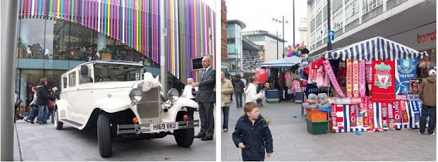
It's Saturday on Whitechapel and the footy scarves take
pride of place.


Everton clearance and a wet Greaty by Peter Leeson.


A snowy February scene 09. Early hours of the morning at
Wavertree Garden suburb. This is the Queens Drive junction with Thingwall Road.


The Tate & Lyle sugar silo conveyor is to be dismantled
shortly, so was captured for posterity.

The Speke Wave. Hellllllo!!!
MOUNT PLEASANT - ISN'T IT

So much grand architecture is on this street but
concentrating on the Southside between Rodney Street and Roscoe Street for
starters are these two fine buildings.


Highest numbers at the top, lowest numbers nearest the Town
Hall which is the same for every street. Here we see No. 66 and number 64a one
of the oldest residences in the city centre dating from the 1760s. In the next
picture we see the continuation of Georgian Splendour with No.64 (with the
yellow door) which back in previous decades served as the South end registry
office and was where John Lennon wed Cynthia Powell. The row continues down the
hill featuring No.62 which has been modernised to a tea rooms.


No.60 (with the blue door) is a grand old building but for
grandness, see the magnificent YMCA building.

The Memorial Gardens which are also the resting place of Roscoe. For the full information, see the plaque.

Mount Pleasant from the top level of its multi storey car park. First looking up to the East and then looking down towards the city centre.

Two more aerial views of places we've walked down a million
times. Looking up Dale Street towards the flyovers and down Water Street
towards the Pier Head, both taken by my mate Chippie from Martins bank
building.


Down our street
The Fort Victoria nestles in Canada Dock as seen from
Bankfield Street. The former Dominion pub is seen on the corner of the dock
road.
Not Amsterdam, but one of the new and massive wind turbines
from the top of Lambeth Road, looking past the newly refurbished Sandhills
railway station.

The Lord Nelson Hotel and the Carling Academy can be seen here as well as the view up Lord Nelson Street.
Neston Street and the view which greets householders of
either persuasion when they retrieve their morning milk.


Two wonderfully atmospheric snow scenes, captured by Gerard Fleming in February 09. The architecture, night setting, street lighting glow and weather combine to make these come to life. The composition is first class, the angles, what's in view and the people positioning.

The East Lancs Road/Townsend Avenue junction and a funeral cortege proceeds unders the bridge at Utting Ave. Pics courtesy of my good mate Dave Duff, cheers Dave.

A familiar sight for me in that I lived at No.4 Trueman
Street for thirteen years. At the beginning, Whitbread's was at the top of the
street and an elavated passageway stretched across the street from one building
to the other (see the post war b&w page). The big brown tankers trundled
the area and smell of the hops brewing was a memory all of its own. The big
Threalfalls chimney could be seen right outside our kitchen window and that
building was demolished for the JMU library which is the new red brick building
on the right of Trueman st. Whitbread's social club was opposite and
occassionally there would be a charabanc party turning up there. The ground
floor of our flat was a part games room with slate bed snooker table and model
railway layout and our bands pracky room which with no near neighbours was
perfect. We could sunbathe on the flat roof in the summer and take our pick
from the caretakers flat roof or that of Blackburn Chambers itself which
offered great views. Dave's sweet shop was built into Blackburn Chambers at the
time so was a great convenience but the city centre was our local anyway. The Mitre
became one of our band's gig venues which was also handy and my job at 99/101
Dale street meant lunchtime at home. How lucky was I.


Take a look up. Some fine architecture peers down onto
Church Street and Parker Street, even St. John's beacon has weathered well.


A recently listed 1700's house in Hockenhall Alley off Dale
Street. 99/101 Dale street was my workplace from 1980 - 1992. Handy, as I lived
in nearby Trueman Street at the time.

Nos. 198 & 200 Grove Street, Liverpool 8. Symetrical splendour.

Walk Tall, walk straight and look L1 right in the eye.....It's The Beatles.
BOOTLE

Bootle village again and a 2009 view of a photo that appears
over 100 years earlier on the 'pre war' page - note the similarities. Above
right: Waterworks Street.


Rose, Stanley and Peel Villas on Litherland Road, Bootle
village. No.2 Merton Road is featured
next.


Hertford Road, Bootle, all tinned up and ready for
demolition. Also shown here is the opposite side with the rears of property on
Keble Road. The last picture shows the huge swathes of derelict land around
Exeter Road and College View awaiting redevelopment. These roads, and others in
the area are named after Oxford and Cambridge University colleges.


Some fine examples of housing in Bootle include this row on
Oriel Road numbered from right to left as No.s 32 to 46 which is unusual as
this is largest numbers being at the Town Hall end of the road, possibly a
feature in Bootle township as opposed to Liverpool's way of numbering. Other
examples include these, the last one being on Merton Road.


Millington's dance school and function suite make good use
of this double fronted villa on Merton Road. The old and the new stand side by
side, firstly on Hertford Road and looking West past Keble Road.


The Willows on Hawthorne Road are more fine four storey
dwellings, the rear of which include an elaborate array of fire escapes.


The refurbed Oriel Road railway station, the double bridge
at Millers Bridge and the split level track.


Bootle industry is not surprisingly largely tied in with the
docks. First is the view from Millers Bridge towards the Irish ferry terminal,
seen closer up in the middle pic. King Storage have a large warehouse on Derby
Road.


The scrapyard dock is situated at the bottom of Lower Bank
View. The Leeds/Liverpool canal runs right through Bootle, seen first here
looking south, towards Liverpool past the back garden of adjacent property and
then north, running parallel with canal street.


The Pacific Steamship Navigation Company offices as were, at
the Canada dock No.2 branch - abbreviated here on the building as PSNC. Further
on is Nortons crap, errr, sorry, I mean Norton Scrap. It starts its life as
full car bodies and the like on the land side of the dock road where it is
cubed then broken down further before making its way across the dock road via
the overhead conveyor belt to be unceremoniously dumped into a slag heap
awaiting shipment elsewhere.


The Northern line runs from Liverpool through Bootle,
eventually to Southport. The Strand and the Triad are pictured next and are the
shopping and business centres. The corner of the dock road and Millers Bridge
is seen here lastly. The former 'Docker's Hook' pub proclaims 'Fine Wines' -
Cargill's tanks on the dock estate no doubt produce fine vegetable oils.


Another view towards Hertford Road from Keble Road showing
demolition in the area. Across Stanley Road and the South East side of Wadham
Road has new foundations going in. The last pics shows the block of shops with
flats above on Stanley Road from its junction with Wadham Road.


Off Derby Road, old property on Lodwick Street, just down from
the disused Woodhouse pub. Further along and old Georgian stock on the corner
of Raleigh Street. Further into town and the Kirkdale area we see housing from
two very different decades. Crocus Street is one of the flower streets off
Stanley Road. The pre war housing on its North side was demolished as unfit
with replacements built in the 1970s.


A view from the grassed area on Commercial Road, Kirkdale,
looking South along the Liverpool/Leeds canal towards the old British American
Tobacco works which are now apartments. The oil storage tanks on the right are
accessed via Sandhills which runs across the bridge in the distance. They were
once part of Samuel Banner & Co. whom I dealt with for their Shipping
imports from India. The next shot is looking West towards the docks down
Effingham Street, Bootle, from Derby Road.


Central Buildings, Crosby, as captured in 2006 by Mike
Murphy. Pritchard's books and Quirk's records now consigned to history on this
row.


Bedford Road underpass with its 'Bootle - A History' mural.


Part of the ongoing demolition around Edge Hill. Milroy
Street with its old 'Woodsons' shop signage is on a row facing its last few
months. The second shot shows the scene further up the street, its East side.
At least there are no such plans to rid Smithdown Road of its vibrant blocks of
shops though as seen here on pic 3.


The West side of Scholar Street has already bitten the dust
as has the top of the East side. Mulliner Street a little further along
Smithdown Road awaits the same fate.


Sefton Road becomes Gorsey Lane leading from Litherland
towards Ford Cemetery at the junction of Richard Martin Road.
Tunnel Road contains these old railway workers cottages
belonging to the Edge Hill station, now bricked up as an ancient reminder.
This big fine old house exists on the corner of Thingwall
Road and Childwall Road in Liverpool 15.


Baltic Street, Lothair Road and Gilman Street are all
situated off the North side of Walton Breck Road just West of Liverpool's
football ground.


1) Rockfield Road, another of the Anfield casualties. 2)
Newman Street, Kirkdale which is off Fountains Road. 3) Across the way and it's
Wykeham Way, a part of the Easby Estate which is coming down.


A small and old row of cottages on the stretch of West Derby
Road leading to Mill Bank at the Muirhead Avenue roundabout. Legend has it one
or more of these are haunted. Ghosts must only haunt old places dont you know.
Gardner Road branches off to a dead end but is lined by this little quaint row.
The North side of West Derby Road from Victoria Road to the roundabout is lined
with shops with flats overhead.


West Derby Village, olde worlde, quaint, quiet, rural maybe
- but not on this day. The police were in evidence and four of the local pubs
were closed and cordoned off due to shootings the night before resulting in
four people being hospitalised. Nevertheless, lovely scenic views can be found
around Town Row and Meadow Lane.

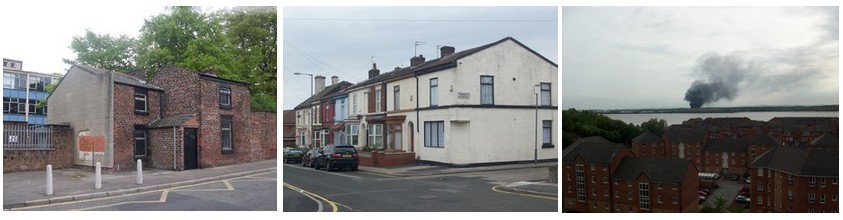
Old property relating to West Derby Comprehensive school can
be found on Bankfield Road. The second pic shows Florence Street at its
junction with Burrell Street off Walton Lane L4. The near property was once a
shop and its diagonal entrance is now bricked up. The property at the far end
is an unusually situated B&B. The last pic taken across the rooftops in
Dingle from Grafton Street shows a fire raging at Bromborough landfill site.


Two views from the top of the steps as you enter the
Metropolitan Cathedral. The first, looking along Hope Street, past the Everyman
Theatre towards the Anglican Cathedral shows the aforemention fire which looks
much more fierce and closer than it actually was.
The second shot takes in the flats on Cathedral Walk as well
as the college building on Russell Street with the Radio City tower behind.


An old open back Corpy bus at St. Johns Lane. The Netherton
and Ford buses used to leave from here and it was where i'd walk my girlfriend
to for her last bus to Kirkdale in 1982. Now she's my wife.
Lime Street traffic, captured from above the now abolished
subway.
The Met Cathedral completes the Bull Ring skyline.


The Klondyke estate in Bootle as row upon row of terraced
housing makes way for redevelopment.
Monfa Rd at its junction with Mary Road, looking North
towards Harris Drive. Someone has a unique way of getting rid of their old
shoes. The next pic is Monfa Road at Staley Street with the demolition boards
in evidence.


Monfa Road 'The Dairy' awaiting its fate. Perspex sheets
cover the doors and windows with notices telling would be thieves that all
valuables have been removed from the empty houses.


Monfa Road looking South, first at Mary Road and then at Elizabeth
Road.


And you're next. Willard Street with its North side boarded and ready for the bulldozer, the South side getting a stay of execution. Staley Street and Humphrey Street have already gone but Glynne Street is still showing signs of life.

An aerial view of Kensington taken on 28th July 1963. From
the top of the picture left to right are the side streets from Farnworth Street
to Denman Street. Jubilee Drive is the main street down the left hand side of
the photograph, then comes the library and Holy Trinity church with Kensington
Gardens behind. The grassed square at the very foreground is the covered
reservoir.


Five photographs of the tin estate which is a nice, quiet,
neat little area of a part of Northern Litherland called Stanley Park which
basically consists of Anderson Road and Harrington Road between Moss Lane and
the main drag of Church Road. The majority of the houses here have their upper
floor clad in corrugated tin and usually painted in a brightly coloured yellow
or beige.


Lascar House, once home to Beldam Asbestos Company started
life as the Anglo American Hotel public house. Seen elsewhere on this page, in
the early hours of the last days of July 09, it collapsed into the street. Seen
here from the dock road and Vandries Street, whose junction it lay at, the
cellars can be clearly seen and in this dangerous condition it surely won't be
long before the rest is pulled down.
Off Jamaica Street..............


The above eight shots take in an interesting and largely
untouched stretch of land from St. James Street to Chaloner Street encompassing
Bridgewater Street, Flint Street, Newhall Street, Watkinson Street, Norfolk
Street, Greenland Street, Brick Street, New Bird Street and Jordan Street.


Since the demolition of Aspinall's flooring on the corner of
Erskine Street and Moss Street, The City wrought iron centre now stands in
isolation as the last remnant of a bygone age. Surely it won't be long before
this is swallowed up in a new development.


Formerly Parry Books, Blackwell's which serves the
University with academic writings is parked on Brownlow Hill. A little further
down on Clarence Street is part of the John Moores Uni, a typical 60s layered
glass structure.


Bootle. Hawthorne Road is seeing some dereliction but this
block just North of Linacre Lane bucks the trend. On the opposite side of the
Lane though, all is cleared towards the Klondyke estate except for this little
piece? Any ideas anyone?


Great Newton Street off Pembroke Place. Blackburn House with
its wholesale newsagent livery looking a bit worse for wear. Second pic is of
Moss Lane in Litherland to the rear of the Priory pub and a nice looking old
Austin van.


The Anglican Cathedral popping through some greenery at
Crump Street. Mill Street showing the recently refurbed Park Palace and a
derelict building sprouting some greenery of its own.


Taken from the roof of my car to see over the boards keeping
would be adventurers away from this decrepit old warehouse on Bridgewater
Street. Almost next door is another showing signs of wear and tear.


A quacker photo here. Four of the WWII landing craft duck
mobiles which do sightseeing tours around Liverpool city centre before plunging
into the Albert Dock for their finale. Resting up here in New Bird Street
(appropriately enough) at the end of their shifts.
Forlorn industry in Garston. A lone chimney on the corner of
King Street and Blackburne Street silhouetted against the rainclouds.


Weaver Cottage and its piano restoration neighbour on
Blackburne Street, Garston.


Garston Docks including the container terminal. The scrap
site is to the left and rail lines are embedded in the quayside.


The lovely light and airy Teapot Cafe on Blackburne Street,
Garston. Actually that's unkind as my mate off the Weaver Industrial Estate
tells me it was very nice for a full English brekkie.
Vulcan Studios take up most of the habitable space in this
old dock road warehouse these days with music belting out from nearly every
floor at some point or another.
The old barred windows and loading bay can be seen in Vulcan
Street and nearby Savages in Vandries Street still advertises the old 051
telephone number above its shutters.


Dungeon Lane is in the direct flightpath of incoming planes
to JLA. You can almost touch these easyjets, and the noise upon landing as the
reverse thrust is implemented is deafening as is the revving up for take off as
the one on the right taxis into position just yards from us.


Breck Road looking East first from Fowler Street and then from Belmont Road. The crowds are just leaving Anfield after their pre-season friendly defeat to Athletico Madrid on Saturday 8th August.
The last pic shows a higgeldy piggeldy of various shaped
buildings including a white one with a gable end chimney at what looks to have
been the original corner of Breck Road and Breckfield Road South before the pub
and cinema (now a 3 piece suite showroom) were added on.

The top end of Eberle Street showing a building which has been in continual use for many decades now. In the 1980s it was a health and fitness club before becoming Images nightclub which also incorporated Flash Harrys bar. For the last few years it has gained prominence as Garlands gay club.

The top end of Eberle Street showing a building which has been in continual use for many decades now. In the 1980s it was a health and fitness club before becoming Images nightclub which also incorporated Flash Harrys bar. For the last few years it has gained prominence as Garlands gay club.
City of Angels is a pampering parlour catering for hair,
nails, tanning etc but is situated in a beautiful setting all of its own, a
fine building which is sadly surrounded by dereliction and wasteland around the
top of Hackins Hey.


Looking Citywards down Leather Lane past Rigbys to Dale Street whilst at Hall Lane the dereliction leading up to the widening of the road has begun right up to Sacred Heart Church near the junction with Prescot Street.

Saturday 8th August saw a massive fire, believed to be an
arson attack, sweep through a building in Stanley Street, Liverpool city
centre. It started in the basement of an Indian Balti house around 6.30 am and
the crews were still there at 5pm when I took these. The building is situated
on the West side of the street near the bottom. First, we are looking down the
blocked road from Dale Street and then there are three views along Victoria
Street, first looking East and then two looking West.
Another little look around the ropeworks area

Wood Street

Back Berry Street

Seel Street old property. Old yes but still functioning as commercial and residential properties.

Well do you? More commercial frontages with their own warehouse and storage facilities. Around the corner is Gostins arcade with the upstairs now having a new lease of life for specialist shopping.

Probe record shop on wood street with some old gable end
signage on the higher property behind. The pavement cafes of Concert Street
give a European feel to this area now.


What remains of Schofield Brothers mineral water
manufacturers though probably better known as Schoey's Lemonade. Their premises
complete with tower were in Dalrymple Street, Liverpool 5 which runs between
Scotland Road and Great Homer Street.


More delapidated remains, this time the Central Cafe right
in the middle of Liverpool on Brooks Alley. How they've survived the recent
renovation of the surrounding area is anyones guess.

Left is the coach house and stables on Roscoe Street hailing from circa 1780 and looking in very good shape considering. Right is the splendid Georgian property on Bold Place to the rear of St. Lukes church looking down towards Berry Street.

Lime Street, taking in the lengthy block from the Crown pub
to the Vines. Renshaw Street, long lauded as Rapid Street has now undergone a change with Rapid's move to the former John Lewis Building and the re-development for Central Village going on behind the former Rapid Premises.


Inside and outside No.69A Renshaw Street, now a varied mix
of music, clothes, jewellery, ornaments and artefacts. It wasn't like that back
in 1979 though when I worked here when it was Quiggins hardware store. Dave
Boner was a lad I worked with and we'd sometimes go the Masonic pub on Berry
Street in our dinner hour, red haired George was the manager behind the counter
who later went to work in another hardware store on Victoria Street but the
real boss man sat upstairs behind an oak desk - a very unapproachable scenario.
Please sir may I have a pay rise. Part of my job was in the warehouse that
backed onto Oldham Street and the closed down property next door on the pic above
was then an Indian restaurant and it used to pong out the back where the flue
was. Another job was taking the mail to nearby Leece Street post office.


The Dock Road Bascule Bridge at Regent Road, closed for the
last year whilst supposedly undergoing renovation work, it now may be condemned
altogether.


Some if its finer workings include the curved mechanisms
which allowed it to open to let vessels through to Stanley Dock from the River
Mersey. They were directed from the overhead housings, Stanley Dock being the
only landside dock and is now used via its locks to allow barges down the
Leeds/Liverpool canal to the new waterway at the Pier Head.


This whole area is full of history and heritage including
Jesse Hartley's 6 sided Victoria Clock Tower and the massive Stanley Tobacco
warehouse.


Two neighbouring streets off Vauxhall Road with some
distance of setts still intact are Gascoyne Street and Eaton Street.
Festive feelings at Liverpool One shopping centre on Sunday
22nd November 09.


And the following Saturday 28th around town.

There seems to have been a passion for blue LED lights over
the last couple of years and very nice they look too in my opinion. Spot the
silhouetted goths on the now disused World Museum steps at dusk. A little up
the street and it's throwing out time at the Walker too.


The Central Library gasometer also gets the festive works.
The circular International Library sits within these walls.


The magnificent St. Georges Hall with its Athensesque
exterior and Romanesque interior sits majestically at the head of St. Johns
Gardens. The cobbled street off William Brown Street known to all who have had
the privilege to work in the hall as the 'van passage' where those on trial
were taken to await their fate inside. Store rooms sit off here to the left and
a large gate at the opposite end leads into St. Georges Place.


Christmas lights galore adorn the leaf shed trees of St
Johns Gardens bringing a festive feel to the area. From the gardens we first
look out across St. Johns Lane to St. Johns House and St Johns beacon, the
Radio City tower doesn't have the same ring to it to me. Then looking down
William Brown Street towards the foot of Dale Street.


Byrom Street with its own illuminations now that the
Churchill Way flyover changes subtly from blue to purple. Williamson Square is
turned into a colourful mini fairground with its own ice rink this festive
season.


The North side of Newby Street, Liverpool 4 with original
housing. The opposite side still has two grand town houses with the newer
housing built in a complimentary design though noticably smaller.


Luton Grove off the East side of Walton Road still has some
old housing on its South side, the rest of the street with newer red brick
developments. Its continuation, Florence Street has its older properties on the
opposite North side, this row, including a b&b facing some very recent
housing.


Lister Road is off Prescot Road and like nearby Lockerby
Road, contains some fantastic old period property. With their cellars and garrets,
these on the left a 4 storeys whilst there are newer 1930s additions on Lister
Crescent which is a well kept private road 100 yards down.


Flashback. Whitechapel showing Llewellyns and the open eye
gallery in the 1980s by Philip G Mayer. For a now comparison, see the 'Then and
Now' page on this site. Pic 2 taken in 1965 by Dave Rogers shows the Queens
Drive/Rice Lane flyover under construction, a good 9 years before its partner
further along the Drive at the Rocket.
Sunday 29th November saw the Merseyside Passenger Transport Executive or MPTE to you and I celebrate 40 years with a fine display of their motorised carriages at St. Georges Plateau which always bring back a memory or two. Gladly, P Gorton was there to capture some of these for old times sake.

Sunday 29th November saw the Merseyside Passenger Transport Executive or MPTE to you and I celebrate 40 years with a fine display of their motorised carriages at St. Georges Plateau which always bring back a memory or two. Gladly, P Gorton was there to capture some of these for old times sake.

The old Corpy open back 56 which ran between St. Johns lane
and Netherton and the A55 Ribble which were both routed via Christian Street
past our house were on show. I can always remember the sloping home straight
down past the rear of the Museum as it came into the terminus at the Old
Haymarket.


Two Atlantean buses seen here, one in Wirralian livery of
the early 1970s, the other in Corpy green and cream. It was a summer weekend
ritual for my mam and dad to take me over to New Brighton on the Royal
Daffodil, straight to the pier or via Wallasey on the Leasowe or Egremont (back
then the Overchurch and the Woodchurch were the Birkenhead ferries). After a
day on the fair it'd be up the hill to Victoria Road which ran at the back of
the big bumpy slide and home on the blue and cream 31 or 32. (possibly one
number ran from Liverpool to Wirral and the other number in reverse). It always
seemed on the top deck that the bus was going to hit the corner of the arched
tunnel roof but it never did of course. There's a pic of a bus running this
service as it comes out of the Kingsway Tunnel on the 'other tenement pics'
page of this site. Appropriately the other pic is of the No.40 (Huyton service)
on the 40th Anniversary.


A single decker one man operation showing the No.1C to
Bootle's Miller's Bridge whilst another open back on the 80E Princes Park route
is pulled up to the rear of the 28 to Netherton which would have plied its
trade along that stretch of Lime Street up until the 1970s.


The 317 Liverpool to Prescot bus, the 60 to Cross Lane via
Whetstone Lane and an open top to Ainsdale Beach - well you wouldn't be going
there in the first place if it was raining would you?

Abbey Lawns Private nursing home on Anfield Road is an imposing building with its fine gates commemorating three Queens in Mary, Victoria and Anne.

There are some fine residential properties on Anfield Road.
The first pic shows the West Side looking across Arkles Lane. The second is a
detached residence converted to flats with a detached brick built garage. The
last row, further North are aestestically pleasant.


Back Commutation Row just off London Road shows a little bit
of time stood still to the rear of the more recent apartment developments on
Commutation Row itself. The cast iron pipework looks ancient yet it could only
have been put in after the warehouse hoist was removed. These properties
actually front onto Camden Street.


Take the cars away and it could be eighty years ago. From
left to right, top to bottom - London Road, Skerries Road, Breck Road -
Anfield, Priory Road and Green Lane.
A little stroll around the Canning district of L8 on a cold but dry December night 09.

Canning Street and Percy Street

Falkner Street x 2
Some MPTE hardware, kindly shared with us by Tony Salmon who when growing up in Woolton, had some real mean steerie models. See here .

Some MPTE hardware, kindly shared with us by Tony Salmon who when growing up in Woolton, had some real mean steerie models. See here .

Index
A: Audley Street, Adshead Road, Aubrey Street, Abercromby
Square, Adelaide Terrace, Alsop School, Arkwright Street, Ainsworth Street,
Anderson Road, Abbey Lawns, Anfield Road.
B: Byrom Street, Burlington Street, Bevington Bush,
Blackstock Street, Bankhall Street, Blackhorse Lane, Bullring, Barlow Lane,
Belle Vale Road, Back Harfield Place, Back Commutation Row, Byford Street,
Berry Street, Bold Place, Breeze Hill Aerial, Bankhall Lane, Back Sandon
Street, Beach Lawn, Bailey Street, Bluebell Lane, Blundell Street, Bridgewater
Street, Birchfield Road, Bridge Road, Blaisdon Close, Benson Street, Bootle
Docks, Bedford Road, Baltic Street, Bankfield Road, Brick Street, Brownlow
Hill, Blackburne Street, Breck Road, Back Berry Street, Brooks Alley.
C: Cases Street, Clayton Square, Church Street, Commutation
Row, Chaucer Street, Christian Street, Church Road (2), Chapel Street, Chatham
Street, Childwall Abbey, Cockburn Street, Clare Terrace, Church Mount,
Churchill Way, Congress Street, Castle Street, Cheapside, Canning Street,
Cresswell Street, Crosby Road North, Crosby Road South, Cressington Park,
Central Station, Church Road West, Carlton Street, Canada Boulevard, College
View, Crocus Street, Commercial Road, Central Buildings Crosby, Childwall Road,
Crump Street, Concert Street.
D: Dale Street, Dovecot Place, Deysbrook Lane, Duke Street,
Derby Lane, Donaldson Street, Dorothy Street, Derby Road, Dungeon Lane,
Dalrymple Street.
E: Elliot Street, Everton Brow, Eldon Grove, East Lancs
Road, Everton Road, East Prescot Road, Erskine Street, Edge Lane, Everton
Valley, Esplanade, Easby Road, Exeter Road, Effingham Street, Eberle Street,
Eaton Street.
F: Fraser Street, Fox Street, Fountains Road, Ford Street,
Flyovers, Flint Street, Fulton Street, Fontenoy Street, Florence Street,
Falkner Street.
G: Gt Howard Street, Grosvenor Street, Gt Mersey Street,
Goodison Road, Gateacre Brow, Gateacre Village, Grange Lane, Garden Street,
Gradwell Street, Gt George Street, Grassendale Park, Gt Crosshall Street, Glassonby
Crescent, Granton Road, Gladstone Road, Gt Homer Street, Grove Street, Gilman
Street, Gardner Road, Glynne Street, Greenland Street, Gt Newton Street,
Garston Docks, Gostins Arcade, Gascoyne Street, Green Lane.
H: Hope Street, Hampton Street, Hale Road, Halewood Road,
Hawthorne Road, Hunter Street, Hall Lane, High Street, Heyworth Street,
Highfield Street, Huskisson Street, Harewell Road, Harcourt Street, Herschell
Street, High Park Street, Hawke Street, Hanover Street, Hockenhall Alley,
Hertford Road, Harrington Road, Hackins Hey, Haig Memorial Homes.
I: Islington, Islington Place, Irvine Street.
J: James Street, Jordan Street, Jamaica Street.
K: Kingsway, Kensington, Kinmel Street, Kensington Aerial,
King Street.
L: Lime Street, Leeds Street, Lord Nelson Street, Lord
Street, Lark Lane, Little Parkfield Road, Little Catharine Street, L1 Shopping
Centre, London Road, Langrove Street, Lewisham Road, Lambeth Walk, Litherland
Road, Lodwick Street, Lothair Road, Luton Grove, Lister Road, Lister Crescent.
M: Moorfields, Mann Island, Manchester Street, Moss Street,
Mount Pleasant, Mill Street, Macketts Lane, Mill Lane, Mount Vernon Street,
Merton Road, Mornington Terrace, Marmaduke Street, Mason Street, Marine
Crescent, Mersey Road, Muirhead Avenue, Millers Bridge, Mathew Street, Mersey,
Monksdown Road, Madryn Street, Milroy Street, Mulliner Street, Meadow Lane,
Monfa Road, Moss Lane, Moor Lane.
N: North John Street, Nelson Street, New Quay, North Road,
North Dingle, Norfolk Street, New Brighton Promenade, Neston Street, Newman
Street, Newhall Street, New Bird Street, Newby Street.
O: Old Haymarket, Oriel Road.
P: Parker Street, Pall Mall, Pilgrim Street, Portland Place,
Park Road, Princes Road, Picton Clock, Paul Street, Prescot Street, Priory
Road, Penrose Street, Pembroke Place, Picton Road, Parr Street, Prussia Street,
Percy Street, Potters Barn Park, Pier Head, Princes Drive, Prescot Road, Porter
Street, Primrose Hill, Powis Street, Peters Lane.
Q: Queens Drive.
R: Richmond Street, Roe Street, Rice Street, Roscommon
Street, Renshaw Street, Rushton Place, Rodney Street, Radcliffe Estate, River
Mersey, Regent Road, Royston Street, Rhiwlas Street, Royal Mail Street, Raleigh
Street, Richard Martin Road, Rockfield Road, Roscoe Street.
S: St. Georges Place, Seymour Street, Shaw Street,
Springfield, Soho Street, Sprainger Street, St. Oswald Street, St Marys Street,
Seel Street, Southern Road, St Andrews Gardens, St Catherines Road, St Johns
Beacon, Steble Street, Scotland Road, Summerseat, St Johns Lane, St James
Station, Stanhope Street, St Domingo Road, Stanley Street, South Road, Sparling
Street, Sefton Street, Sudley House, Sefton Street, Strand, Sandringham Road,
Stanley Road, Salisbury Road, Speke Boulevard, Smithdown Road, Scholar Street,
Sefton Road, St Johns Lane, Skerries Road.
T: Temple Court, Tempest Hey, Tithebarn Street, Tyrer Street
(2), Thingwall Road, Towerlands Street, Tower Street, The Strand, Thorburn
Street, Townsend Avenue, Trueman Street, Tunnel Road, Town Row.
U: Upper Parliament Street, Upper Mason Street, Upper Duke
Street, Utting Avenue.
V: Victoria Street, Vauxhall Road, Vernon Street, Venmore
Street, Venice Street, Varthen Street, Vulcan Street, Vandries Street.
W: Williamson Square, Whitechapel, Water Street, Wapping,
Whitely Street, Waterloo Road, Woolton Village, Western Avenue, Wavertree Road,
Walton Hall Avenue, Wavertree Nook Road, Wavertree Garden Suburb, William Brown
Street, Walton Road, West Derby Village, Walker Street, Waterloo Railway
Station, West Derby Cottage Homes, Walton Hospital, Walton Village, William
Henry Street, Winifred Street, Waterworks Street, Wykeham Way, West Derby Road,
Willard Street, Watkinson Street, Wood Street.
Y: Yates Street.