Click on the first image to view all photographs in 'Lightbox' (TM)
For a quick search whilst on this page press Ctrl +F (Windows) or Alt+F (Mac) and enter the street/place you are looking for.
 |
| Aircrafts being transported at Queens Drive, Breeze Hill |
 |
| Atlas cinema, Rice Lane -16-09-1958 |
 |
| Breeze Hill -9-in 1960 |
 |
| Breeze Hill Junction with County Rd and Rice Lane |
 |
| Buchanans Buildings Rice Lane from Northcote street in 1905 |
 |
| Devonfield road park on 11.06.15 |
 |
| Dunlops factory fronting onto Rice Lane and in the distance, the Jewish cemetery - 1963 |
 |
| Grace Road from Walton Vale - June 73 |
 |
| Hartley Village - the jam factory off Long Lane Aintree L9 |
 |
| Hartleys jam factory, Hartleys village, Aintree. |
 |
| Higher lane fazakerly |
 |
| Kingfield rd near Devonfield rd 19-8-74 |
 |
| Long Lane in 1930 |
 |
| Lower Lane air raid shelter in 1939 |
 |
| Millars garage Rice Lane in 1930 |
 |
| Queens Drive at Breeze Hill junction in 1952 |
 |
| Orrell Park bridge |
 |
| Queens Drive at Breeze Hill junction in 1952 |
 |
| Queens Drive at Breeze hill |
 |
| Queens Drive at Rice Lane 22.5.1908 |
 |
| Queens Drive at Rice Lane in 1909 with the baths now completed. |
 |
| Rice Lane at Breeze Hill 1956 |
 |
| Rice Lane at Dunlops showing the old Zoo entrance. |
 |
| Rice Lane showing the Plough pub and Atlas cinema in 1958 |
 |
| Roosevelt Drive - Aintree |
 |
| Scweppes Aintree trading estate on 12.11.52 |
 |
| Southport road from Breeze Hill |
 |
| Stalmine road 21.5.73 |
 |
| Standard Brands factory, Aintree Trading Estate 17.10.52 |
 |
| Stopgate Lane 1950 |
 |
| The Black Bull fork |
 |
| The Pizzy at Aintree races |
 |
| Vernons pools building which was to become the Paradox nightclub. |
 |
| Walton Junior school. |
 |
| Walton Library, Rice Lane in 1929 |
 |
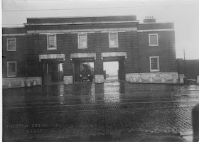
| Walton Park gates 1924 |
 |
| Walton Police station E division at 85-89 Rice Lane |
 |
| Walton Prison 25-07-1949 |
 |
| Walton Prison, Hornby Road 21-05-73 |
 |
| Walton Vale bridge widening at the Black Bull on 5-5-1933 |
 |
| Walton Vale bridge widening on 5.5.1933 |
 |
| Walton prison 1922 |
 |
| Walton prison in 1930 |
 |
| Warbreck Moor park - 18.4.39 |
 |
| Warbreck Moor |
 |
| Breeze Hill in 1960 |
 |
| Longmoor Lane Fire Station in the winter of 1930 |
 |
| Fazakerley Hall estate shops in lJuly 1935 |
L11
 |
| Beverbrook Road in 1930 |
 |
| Boot Estate construction |
 |
| Boot Estate when new |
 |
| Broad Lane 21.7.75 |
 |
| Broad Lane from New Hall Lane on 21.7.75 |
 |
| Broad Lane near Broadway on 21.7.75 |
 |
| Broad Lane north side near Broadway junction on 21.7.75 |
 |
| Broad Lane Nos 42-54 on 21.7.75 |
 |
| Broadway 4.3.60 |
 |
| Broadway 21.7.75 |
 |
| Broadway at Utting Avenue East on 9.8.39 |
 |
| Construction off Broad Lane |
 |
| Coronation Court foundations in 1954 |
 |
| Coronation court |
 |
| Coronation Court opening plaque |
 |
| Coronation Court. One of Liverpool's first high rise blocks of flats. |
 |
| Coronation court |
 |
| Croxteth Comp in 1981 |
 |
| Lewisham road in 1930 |
 |
| Lowerhouse Lane roundabout and prefabs from the roof of the newly erected Coronation Court high rise block. Taken on 06.05.57 |
 |
| Mace Road, Croxteth. |
 |
| Muirhead Avenue East - 1930 |
 |
| Norris Green clinic in 1930 |
 |
| Norris Green Estate housing - 1930 |
 |
| Norris Green Estate housing when new in 1930 |
 |
| Norris Green school in 1929 |
 |
| Norris Green shops |
 |
| Scarisbrick Road Norris Green on Coronation day 2.6.53 |
 |
| Stonebridge Lane 12.5.50 |
 |
| Stonebridge Lane 12.5.50 |
 |
| Stonebridge Lane 12.5.50 |
 |
| Stonebridge Lane heaped rubbish during the refuse strike of 1975 |
 |
| Stonebridge Lane on 12.5.1950 |
 |
| Storrington Avenue and Stonebridge Lane - 1973 |
 |
| Storrington Avenue fire station |
 |
| Strawberry road, Norris Green |
 |
| The Norgreen Centurion Social Club |
 |
| The Regal Cinema, Norris Green |
 |
| The Regal on Broadway |
 |
| Townsend Avenue prefabs - Late 1940s |
 |
| Townsend Avenue under construction on 30.06.1928 |
 |
| Townsend Avenue |
 |
| Townsend Avenue_ |
 |
| Trispen Road on the Croxteth Estate. |
 |
| Winterburn heights demolition. |